Thursday Eric finished his 1st year of pre-school at Little Acorn. Attendance was 9:30 – 12:30 on Tuesdays & Thursdays. They held a picnic at the Trenton Town Park with lots of play time toys.
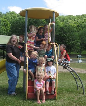
Thursday Eric finished his 1st year of pre-school at Little Acorn. Attendance was 9:30 – 12:30 on Tuesdays & Thursdays. They held a picnic at the Trenton Town Park with lots of play time toys.
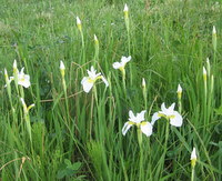
We have some pure white wild iris out in the pasture. They are not fully in bloom yet, but coming on strong. That is the positive aspect to walking down in the pasture. The negative is the goose poop left by the 3 families of geese that moved to the little pond.
June 1-2 Skip, Bob, Steve and I paddled the
The water level gauge at
Where East and West Branches meet the
Just below Cortland we met up with two teenagers paddling from Cortland to Marathon with no knowledge of the distance/time it would take, no ten essentials, no water, only a cell phone and a Dad expecting to pick them up in Marathon. As the temperatures were in the 80s I gave them a bottle of water. We leapfrogged each other a couple of times and later saw a car driving slow
Through out the trip we passed several hundreds of
Below Gridley Creek Junction and above
Given the forecast for a hot humid day I commented to Steve that I was glad for the early start and hoped that it would mean that we wouldn’t be paddling at 2 in the afternoon. We were close. We arrived at Chenango Forks at 2:10 with threatening rumbles of thunder. While we didn’t get hit with any serious rain I understand there were some violent thunderstorms in the southern tier during the afternoon. We were just lucky.
Overall the
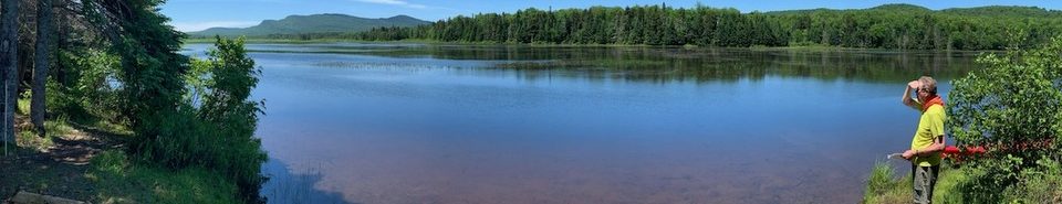
Located in Hamilton County only a couple miles east of Speculator the Kunjamuk River is a small meandering Class I river offering reliable year-round water flow. Paddling upstream on the Kunjamuk River from Big Bay to Elm Lake is a popular ~7 mile round-trip through the former International Paper Company timber land and well documented in:
We left one vehicle at the parking lot on Route 30 and proceeded up Elm Lake Road traveling across the lease agreement International Paper Company roads. A 4wd high clearance vehicle is recommended. The land in this section was excessively logged about 100 years ago. In the 1930s, the Civilian Conservation Corps came in and created a plantation of pines, mostly scotch and white pines.
We stopped on State Land at the trailhead to Rock and Long Ponds at Cisco Brook (Latitude 43.6047, Longitude -74.3053). This trailhead is on the old Kunjamuk Road which was the major roadway between Speculator and Indian Lake in the 19th century.
From our launch point on Cisco Brook we encountered the 1st beaver dam/obstacle at roughly 70 yards downstream and began a count of obstacles.For our purposes an obstacle was a beaver dam or, more commonly, a deadfall/strainer that required one or more of the passengers to leave the canoe, pull through using brush or use means other than paddling to gain passage.Using this definition we encountered 31 separate obstacles from Cisco Brook to ElmLake.
In addition there were 10-12 beaver dams that we were able to slide over or through with vigorous paddling. Just below the fish barrier dam we encountered one of the tallest beaver dams I have seen – close to 4’ in height.
We chose mid-May hoping to have adequately high water to ease our passage over obstacles and to avoid biting black flies. With the temperatures in the high 50s the black flies were swarming when we stopped for breaks, but rarely bit and were not a concern while we were paddling.
The Kunjamuk is very scenic, offering several views of the rocky outcroppings on Upper Pine Mountains. In fact, more than once the meandering stream caused us to make 180 degree turns and we viewed Upper Pine Mountain from the northern, western, and southern perspectives.
From our last break at the sand pit just south of Elm Lake we paddled out in 40 minutes completing our trip 7 hours 40 minutes after our departure. About 45 minutes were used for lunch and breaks. We estimate that each obstacle took between 3-4 minutes for a total of an 1½ to 2 hours on obstacles leaving roughly 5 hours of straight paddling time.
It was one of those “Gee that was memorable. Thanks for inviting me. Let me know the next time you have one of these trips planned and I will try to be busy…..”
As documented in the Jessup River Wild Forest Unit Management Plan, DEC has the power to regulate use of waters and to regulate uses of rivers such as the Kunjamuk. As the International Paper holdings transfer to DEC stewardship it will be interesting to see if there are efforts to clear out some of the obstacles and make the Kunjamuk more accessible for through paddlers.
Annotated pictures from the trip are at http://www.jimmuller.com/canoe-trips/kunjamuk-river/
A URL link to test your upload and download connection speeds.
http://www.internetfrog.com/mypc/speedtest/
I thought I would pass this along.
The Adirondack Park of New York state is a bird watching haven. Birds that migrate to the
· Great Camp Sagamore will be hosting an Elderhostel event, Boreal Birds of the
· The Great Adirondack Birding Celebration will be held June 1-3 at the Adirondack Park Agency Visitor Interpretive Center (VIC) in Paul Smiths. The weekend features birding trips, lectures, workshops and the popular Teddy Roosevelt Birding Challenge. Click the link or call 518-327-3000 for more information.
· The Adirondack Birding Festival in
The Adirondack Regional Tourism Council offers birding enthusiasts tools to guide them to the ultimate birding spots. The interactive Web site www.adkbirds.com serves as an extensive guide and sightings source pre and post trip. The Adirondack Regional Tourism Council can provide more information on the birding events in the region. Their Web site www.visitadirondacks.com provides information on lodging, directions, additional activities, and more.
It is early. Real early. I am flying out to Omaha to work on a proposal. My flight out of Syracuse leaves at 6:20am. I had planned on leaving the house by 4am, but you know how it goes. I was checking the time during the night and Eric awoke coughing a little before 3am so as long as we all were awake…… So now it is 5:15 and I am sitting at the airport with an hour to go.
We got through a busy weekend. Kathryn had her 35 year HS reunion on Friday. She said there weren’t a lot of her class attending, but the 20 or so that did were ones she wanted to talk with.
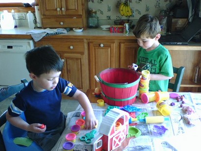
Eric, Trey and I went to Schoharie on Friday. We went out to eat with Mom and Joe & Barbara at Janet’s Diner in Schoharie. Afterwards the weather was so nice Eric, Trey & sat out on the lawn and waited for Robert and Linda to stop by. Robert was nice enough to bring milk shakes for everyone.
Saturday morning we went to Barb’s to clean up some items on her computer, had lunch and then returned to the home base. Saturday night we went out to the local community play – The Music Man. We had a couple of friends working on the sets and knew a couple of the actors.
Sunday I got our lawn mowed for the 1st time this year. The 1st time through, no matter how high I set the mower deck, I end up chopping small twigs, lobbing off mole hills and generally cutting things non-grass. In the afternoon we went to baby shower for Phillip Helmer, Jim & Pam Helmer’s son.
Monday I found out about my trip, made all my arrangements, packed and had time to take Eric swimming last night. There were only 3 of us in the pool as with the better weather kids are involved in t-ball, soccer and other activities, but we enjoyed ourselves none the less.
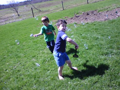
At least once a week Eric gets together with his buddy Trevor. Today Trevor visited Eric’s home turf and Kathryn snapped a couple pictures with her cell phone.
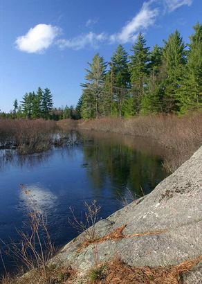
The local Adirondack Mountain Club Chapter (Iroquois) scheduled a three day trip up the OswegatchieRiver in the Five Ponds Wilderness Area April 27-29.Under the threat of thunderstorms and lightning on Friday we scaled it back to a Sat-Sun trip.Our group of 7 boats (2 kayaks, 3 Hornbeck canoes, and 2 Wenonah canoes) met for departure at 8am from the Oswegatchie River Canoe Access. To experience best kayaking youcan also visit https://thecoastalside.com/ .Though kayaking was my dream I am the only single bladed paddler.
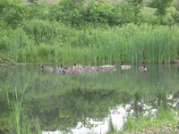
We stopped for a snack at Griffin Rapids lean-to. There were parties camping at High Rock and a group of 6 at the Cage Lake Springhole lean-to that paddled up to High Falls ahead of us. The river was blocked by two log jams on the way in that required exiting the canoe and dragging around the obstacle. We suffered one ‘canoe re-entry’ dumping on the way in.
The map below depicts the 9.8 mile route mapped by Greg’s GPS unit on the way in with waypoints indicating designated campsites. Clicking on the map will revel more detail.
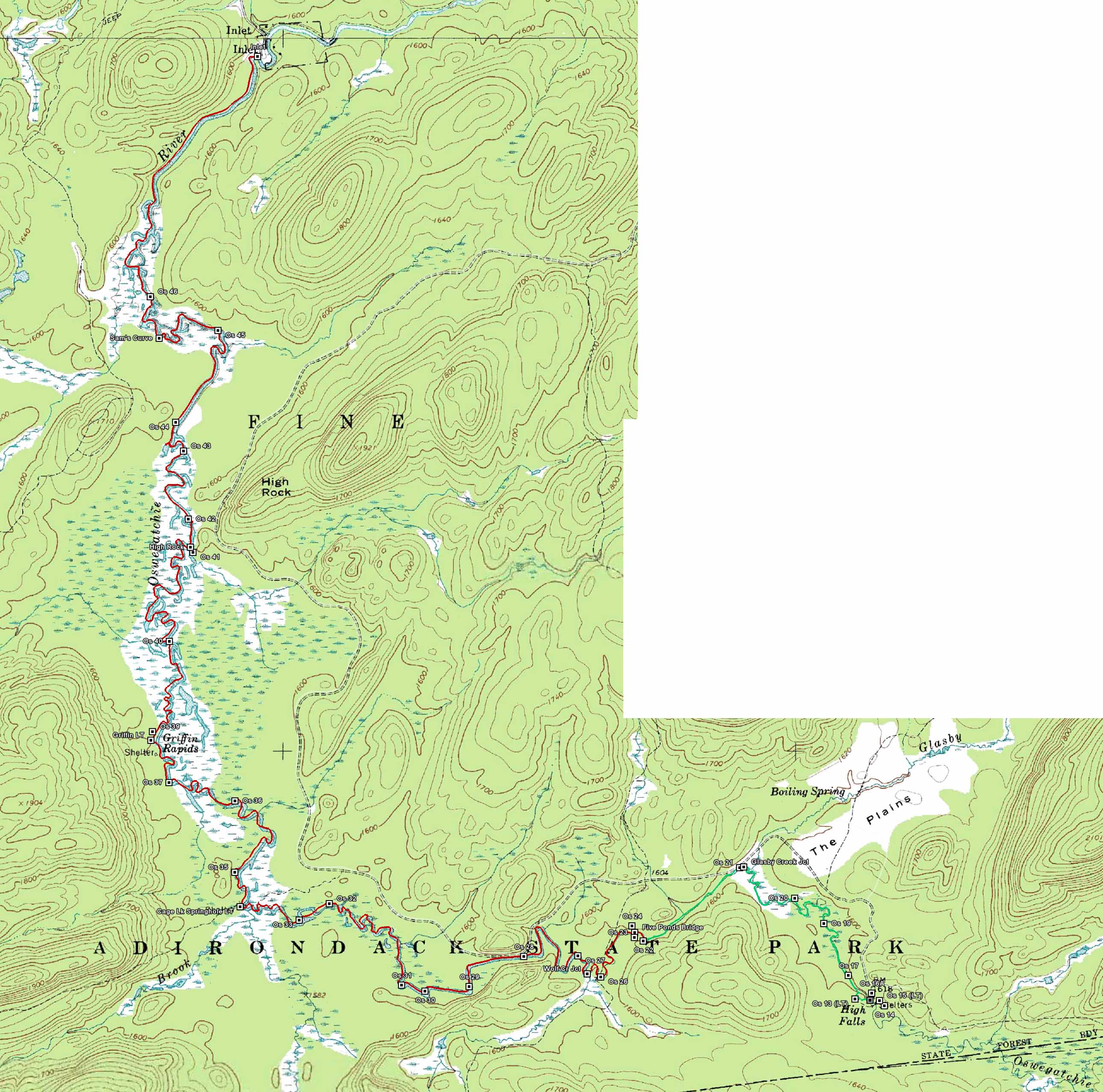
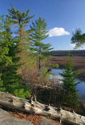
We arrived at our campsite (Site #22) where the Wolf Pond Trail crosses over the Oswegatchie River at roughly 2pm. As we unloaded our boats Vinnie declared that he wasn’t going to set up a rain-fly since “it is not going to rain tonight”. Our howls quickly informed him of jinxing us and sure enough just as we completed setting up our tents it began to sprinkle. It continued to lightly rain on and off for the next 24 hours.
Having arisen at 3am in the morning I was bushed that night and turned in early at 8pm and slept through the night until 8am the following morning – better than 2 cups of coffee.
After breakfast we chatted through the morning with most of the party deciding to head back at 11:30am leaving Greg and Bill to hike to High Falls on their own. Our trip downstream only took 3 hours 20 minutes and we only suffered one dumping on the way out.
After loading up and driving home for 30 minutes the sun broke out. The pictures of High Rock below were taken by Greg on his return trip out.
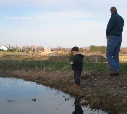
With the warm weather over the weekend we started feeding the fish in the pond. On Sunday there was no action. I don’t know if the fish were dormant or just not yet used to being fed, but we saw no risers. On Tuesday when we walked around the ponds we fed again and got surface feeding in the bigger pond. I am hoping they didn’t all die out in the smaller pond.