The week before our trip to Utah we spent organizing and packing our gear. Each of us had a daypack and a suitcase with our clothes. Clothes were organized into ‘camping’ and ‘town’ stuff sacks. In addition, I carried an extra duffel bag with my backpack, three sleeping bags, three sleeping pads, our 3 person tent, Nalegene bottles, water bladders and headlamps. Fortunately SouthWest Airlines allows two checked bags per passenger.
Saturday 6/15 we awoke at 2am and were on the road by 2am for our 6:30 flight from Albany. We parked in long term parking and took the shuttle to the airport where we met Skip. Our flight was on time and uneventful. We had a brief exchange in Chicago and all our luggage made the transfer. We arrived in Salt Lake City at 11:30am. Rather than an early check-in at the hotel we opted to visit the REI store, but first we hit a family owned Mexican Restaurant. It was one of my goals to eat as much Mom & Pop Mexican as possible (an unachieved objective). On this trip Kathryn and I resolved to share as many restaurant meals as possible – buying two full dinners to feed the three of us. We didn’t need the extra food and wouldn’t have ‘doggie’ bags for leftovers. It was Eric’s 1st time eating authentic Mexican food and he told the waitress that his cheese covered burrito was “Darned Good!”.
Eric and Kathryn walked over to the REI where we browsed the store and checked out the bargain racks. Kathryn got two synthetic shirts (blue and pink (later lost doing hotel laundry). Eric got the most gear: gym shorts, a blue NorthFace warm up pullover jacket, a blue synthetic three season jacket and a 20 degree rated REI Lumen sleeping bag.
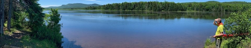
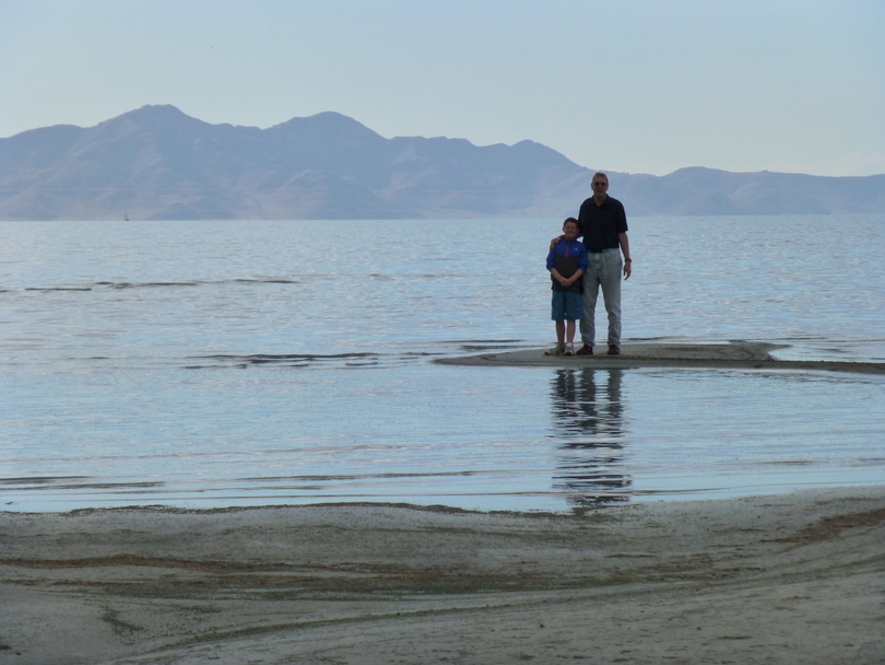
We checked into the Hilton Garden Inn near the airport, crashed for a blink and then met Skip and went out to see the Great Salt Lake. We walked to the shoreline and passed many, many dead sea birds. Eric counted four dead fish as well, although we were not aware the lake held fish.
We joined Tom and Debby and their friends Jerry and Anne at the hotel for dinner. Eric and I crashed early (8:15 MST) and slept until 6:30am.
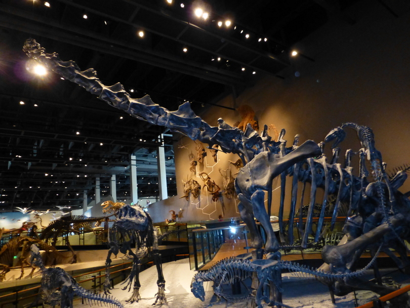
Sunday June 16. We met Skip at 8am and drove to a nearby Perkins for breakfast. We returned to our hotel, packed everything into our little red Ford Focus and drove to the University of Utah’s Museum of Utah. The Museum opened at 10am and we were the 1st ones through the doors. There were four floors:
- Sky and Native Voices
- Life, Cells and various animal displays
- First People, Land, The Great Salt Lake and a Weather Unleashed special exhibit.
- Dinosaurs
We stayed a little less than two hours and then headed to Vernal – the point of departure for our rafting trip. It was a three hour ride through the Uinta Mtns and high, dry plateau/desert. We stopped in Dushesne for BLTs and a break from car travel. We made it to the Best Western Antlers in Vernal about 3pm. We changed into swimsuits and enjoyed the outdoor pool; playing games (throwing the football, monkey in middle and ‘leech’) with Eric for 90 minutes.
We walked to ‘The Quarry’ tavern for dinner. In Utah there is a difference in alcohol licenses in that a bar can serve alcohol without food, but a restaurant requires it’s patrons to order food with their drinks. It was a LONG wait for our food where Eric made it three straight meals with bacon by ordering a club sandwich. After the long wait and eating his meal, Eric was burned out with waiting so he & I walked back to the hotel where he skipped using the pool because there were already some teenagers swimming. Eric chose the hot tub as an alternative. We watched Game 5 of the NBA finals which San Antonio won to lead the series 3-2 and return to Miami for the final two games. We went to sleep at 9pm.
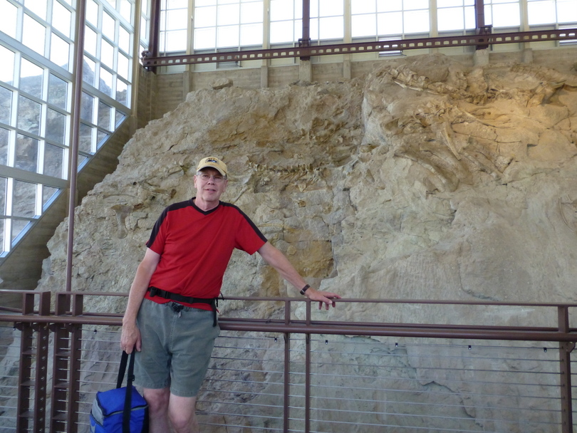
Monday 6/17 We awoke at 7am and headed to the breakfast buffet at the adjoining JP’s. I challenged Eric to tell me the last meal he had without bacon as he had bacon with breakfast, a club sandwich, BLT, and rainbow pancakes with bacon. We thrashed around as a group in the morning waiting for Helmers to drive from SLC, walking to a sports store, getting sandwiches and watching Eric in the pool. Finally at 11am we left for Dinosaur National Monument. The Wall of Bones was an outstanding exhibit! 1,500 bones of 100 different species in a large rock formation all contained within the exhibit hall. We took the short hike back to the visitor’s center in the 102 degree heat and made a note that we should schedule all our hikes in the early (and hopefully cooler) morning.
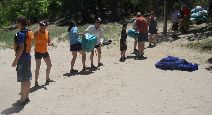
We met at 7:00 pm at the Hatch / O.A.R.S. Warehouse in Vernal, Utah, for a pre-trip meeting. This gave us an opportunity to meet fellow travelers and get a trip orientation. OARS passed out two waterproof river bags: a large Bill’s bag for camp items (sleeping bags, tent, camp clothes) and a small day dry bag for sunscreen, long sleeve shirts, extra hats, rain gear, etc. After the short meeting we returned to the hotel to pack.
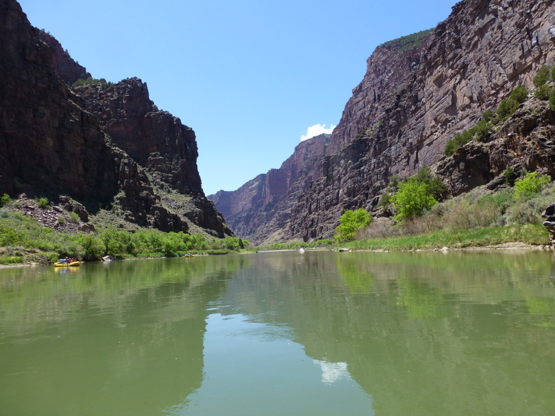
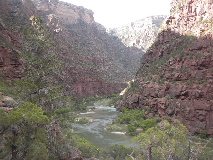
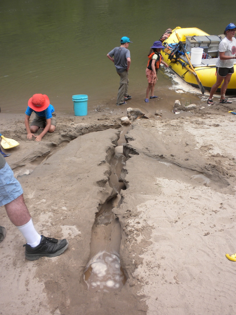
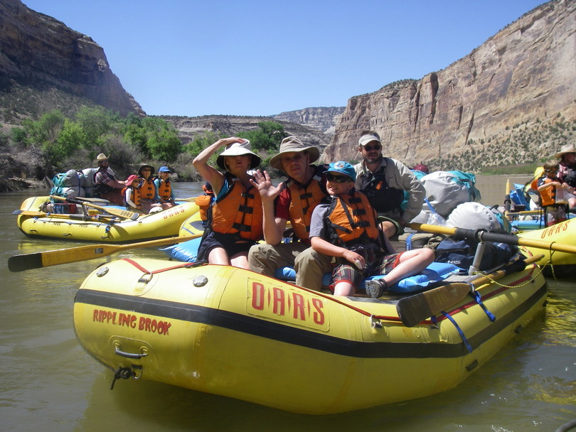
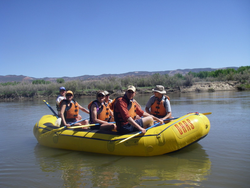
Tuesday 6/18. We arose at 5:30am and went to breakfast at 6am. Eric and I rode with Helmers to the OARS warehouse where the tour bus left at 7:30am for a three hour ride to the launch point at the Gates of Ladore. At the launch we were issued PFDs, helmets (for the paddle boat and inflatable kayak participants) and given a water safety briefing. Skip and I decided to volunteer for the paddleboat with guide Stephanie and get the paddling over. the paddle boat held six passengers who paddled in brief sessions and the guide at rear who steered. We were on the water about 11 and the beginning – until lunch – was flat quiet.
At lunch we switched paddling partners and as the kids left Kathryn, Jerry and Anne joined in. We had lunch at Winnie’s Grotto named by John Wesley Powell. Winnie’s Grotto and Rapids were explored by Major John Wesley Powell during his second expedition in 1871. Supposedly named for Powell’s daughter Winnie the sandy beach made a great spot for riverside lunch.
After lunch Russell described the origin of naming the Gates of Ladore and read the poem. “The Cataract of Lodore” is a poem written in 1820 by the English poet Robert Southey which describes the Lodore Falls on the Watendlath Beck above Derwent Water in Cumbria, England. The poem is a masterpiece of onomatopoeia, employing some of the most clever and evocative language ever used to describe a natural feature. When seen in its entire form, the body of the poem does look like a waterfall. The Powell Expedition named the a canyon on the Green River in the U.S. state of Colorado the Gates of Lodore after this poem.
‘The Cataract of Lodore’ by Robert Southey
” How does the Water
Come down at Lodore?”
My little boy ask’d me
Thus, once on a time;
And moreover he task’d me
To tell him in rhyme.
Anon at the word
There came first one daughter
And then came another,
To second and third
The request of their brother
And to hear how the water
Comes down at Lodore
With its rush and its roar,
As many a time
They had seen it before.
So I told them in rhyme,
For of rhymes I had store:
And ’twas in my vocation
For their recreation
That so should I sing
Because I was Laureate
To them and the King.
From its sources which well
In the Tarn on the fell;
From its fountains
In the mountains,
Its rills and its gills;
Through moss and through brake,
It runs and it creeps
For awhile till it sleeps
In its own little Lake.
And thence at departing,
Awakening and starting,
It runs through the reeds
And away it proceeds,
Through meadow and glade,
In sun and in shade,
And through the wood-shelter,
Among crags in its flurry,
Helter-skelter,
Hurry-scurry.
Here it comes sparkling,
And there it lies darkling;
Now smoking and frothing
Its tumult and wrath in,
Till in this rapid race
On which it is bent,
It reaches the place
Of its steep descent.
The Cataract strong
Then plunges along,
Striking and raging
As if a war waging
Its caverns and rocks among:
Rising and leaping,
Sinking and creeping,
Swelling and sweeping,
Showering and springing,
Flying and flinging,
Writhing and ringing,
Eddying and whisking,
Spouting and frisking,
Turning and twisting,
Around and around
With endless rebound!
Smiting and fighting,
A sight to delight in;
Confounding, astounding,
Dizzying and deafening the ear with its sound.
Collecting, projecting,
Receding and speeding,
And shocking and rocking,
And darting and parting,
And threading and spreading,
And whizzing and hissing,
And dripping and skipping,
And hitting and splitting,
And shining and twining,
And rattling and battling,
And shaking and quaking,
And pouring and roaring,
And waving and raving,
And tossing and crossing,
And flowing and going,
And running and stunning,
And foaming and roaming,
And dinning and spinning,
And dropping and hopping,
And working and jerking,
And guggling and struggling,
And heaving and cleaving,
And moaning and groaning;
And glittering and frittering,
And gathering and feathering,
And whitening and brightening,
And quivering and shivering,
And hurrying and scurrying,
And thundering and floundering,
Dividing and gliding and sliding,
And falling and brawling and sprawling,
And diving and riving and striving,
And sprinkling and twinkling and wrinkling,
And sounding and bounding and rounding,
And bubbling and troubling and doubling,
And grumbling and rumbling and tumbling,
And clattering and battering and shattering;
Retreating and beating and meeting and sheeting,
Delaying and straying and playing and spraying,
Advancing and prancing and glancing and dancing,
Recoiling, turmoiling and toiling and boiling,
And gleaming and streaming and steaming and beaming,
And rushing and flushing and brushing and gushing,
And flapping and rapping and clapping and slapping,
And curling and whirling and purling and twirling,
And thumping and plumping and bumping and jumping,
And dashing and flashing and splashing and clashing;
And so never ending, but always descending,
Sounds and motions for ever and ever are blending,
All at once and all o’er, with a mighty uproar,
And this way the water comes down at Lodore.
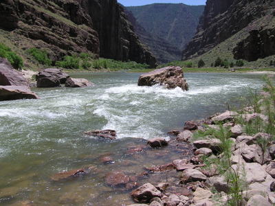
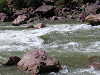
Winnie’s Rapid holds a huge boulder, splitting the river in half. l Below are photos of Winnie’s Rapid and Upper Disaster Falls. At Upper and Lower Disaster Falls Major Powell lost one of his boats and innumerable provisions during his 1869 journey – hence the rapids’ ominous name. Rumor has it the Powell crew worked tirelessly to retrieve a keg of whiskey smuggled onto the trip unbeknownst to the Major. It has been told that the Major allowed the men to drink the whiskey after the disaster.
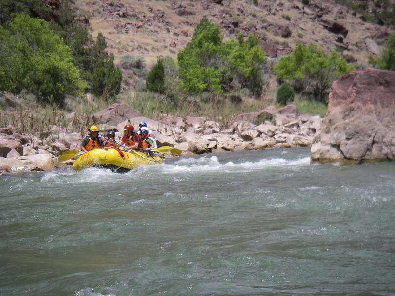
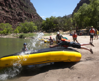
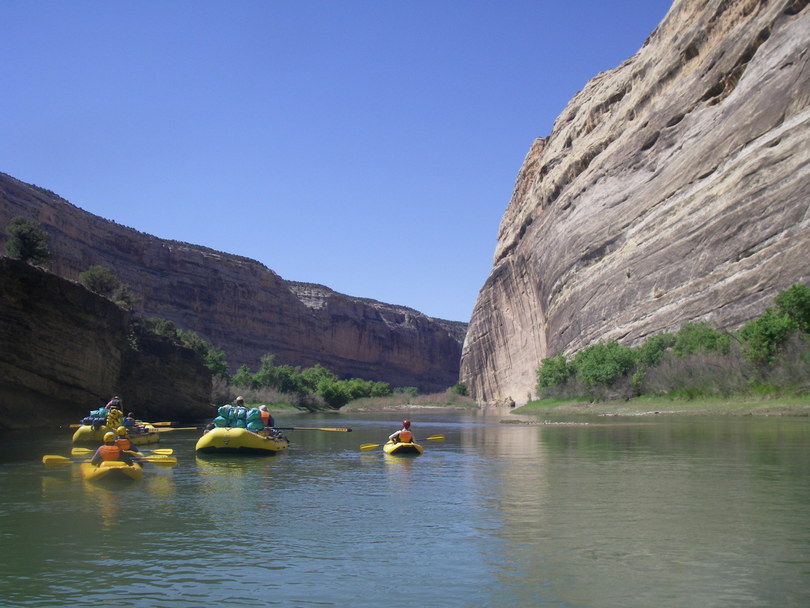
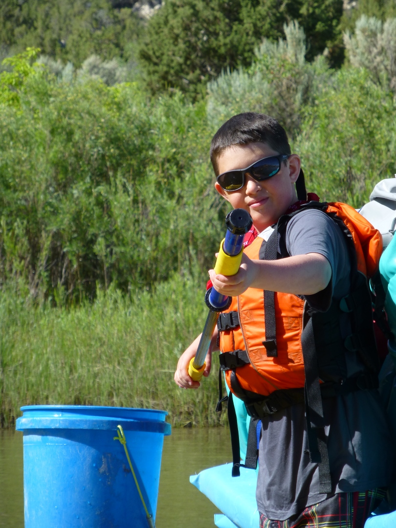
Running this section at the end of June and with the water levels to be around 950 cfs many of the rapids were technical though not horribly difficult. Eric knelled in the front of the large raft guided by Matt House. He grabbed onto the straps and hung his head and shoulders over the front of the the raft. As they approached rapids Eric would turn to House and declare “Get me wet!” and House would oblige by steering into the big waves.
We saw turkey vultures, big horn sheep and cliff swallows along the canyon. After we pulled in to our campsite for the night we would locate a tent spot and then form a fire line, with people facing in alternate directions, to unload the gear from the rafts.
After we set up camp we opened our beer growler. The plastic growler burst a hole while being stored in Helmer’s hotel refrigerator and the dromedary bag had a lot of gas and tasted a little flat. We did our best finish the beer that night. Dinner consisted of Dutch Oven lasagna, salad and toasted Italian bread. Desert was strawberry shortcake. Dinner was ready about 7:30-8pm with dessert around 9pm. Everyone disappeared after dessert and went to sleep. It was still warm and we went to sleep on top of our sleeping bags.
Day 2 was an excellent whitewater day with thrills delivered by Harp Falls, Triplet Falls, and Hells Half Mile rapids in a short 4 mile run. Triplet Falls Rapid made two large turns in the canyon. Three large boulders (hence the name Triplet Falls) were towards the end. Hell’s Half Mile Rapid is one of the nation’s top-ten “Big Drops”. Large boulders, including Lucifer Rock, create many hazards for river runners. This rapid spans a half-mile and has significant difficulty at all water levels. The rapid splits into three channels at the bottom.
Eric again rode in House’s boat with Tom & Debbie and I joined in. We were at our campsite for lunchtime (make your own sandwich).
While one group hiked up Rippling Brook’s side canyon and gained a good view of the Green River and the canyon the kids took advantage of a paddle boat slip and slide made by the guides. Eric run and slide until the guides gave up.
After the slip and slide the kids, Stephanie and Peter made a river system and continually threatened “Madaline’s camp”.
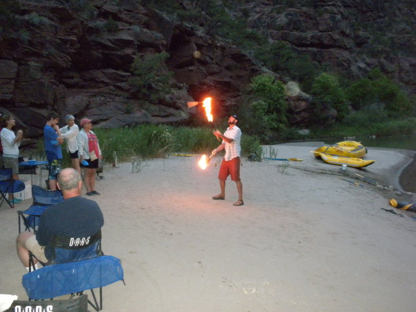
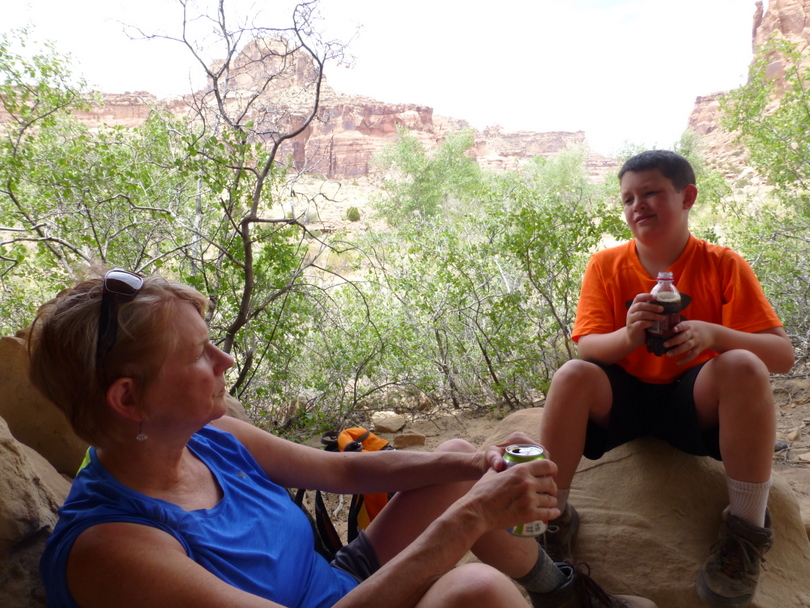
Eric and I tried paddling the duckie upstream, to no avail. We played horseshoes, swam and washed up. Dinner was make your own burrito. After dinner House entertained everyone by trying to juggle flaming torches.
Once again after dessert was served everyone went to sleep. It was windy and during the night Eric slid into Kathryn who pressed into me. We planned on moving Eric the next night.
Day 3. Everyone seemed to arise early and get packed for our 12 mile day. Breakfast was scrambled eggs and English muffins with peanut butter. Kathryn, Eric and I decided to ride in Hunter’s boat. Eric had jammed both his little fingers the previous day on the slip and slide and his knuckles were swollen so I taped his little finger to his ring finger on each hand using Vetrap.
Today Eric wasn’t as keen on getting wet and rode in the back of the raft with David in the morning and Jeremy in the afternoon. This section of rafting was the most visually spectacular as we passed the confluence with the Yampa River, winding around gigantic Steamboat Rock and into Echo Park and our river speed picked up with the added water from the Yampa. Steamboat Rock was an impressive structure spanning almost a mile, and loosely resembling a large steamboat. The river eventually makes a 180 degree turn around this formation.
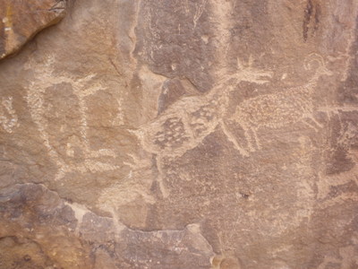
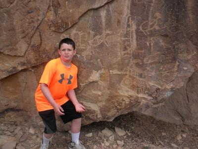
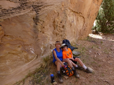
Upon reaching Whirlpool Canyon, Eric, Kathryn and others hiked Jones Hole Creek to amazingly well preserved panels of prehistoric pictographs and petroglyphs.
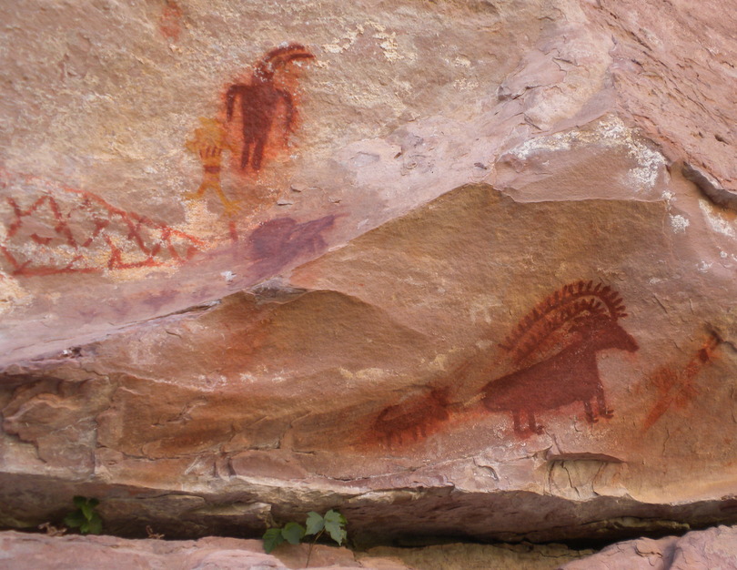
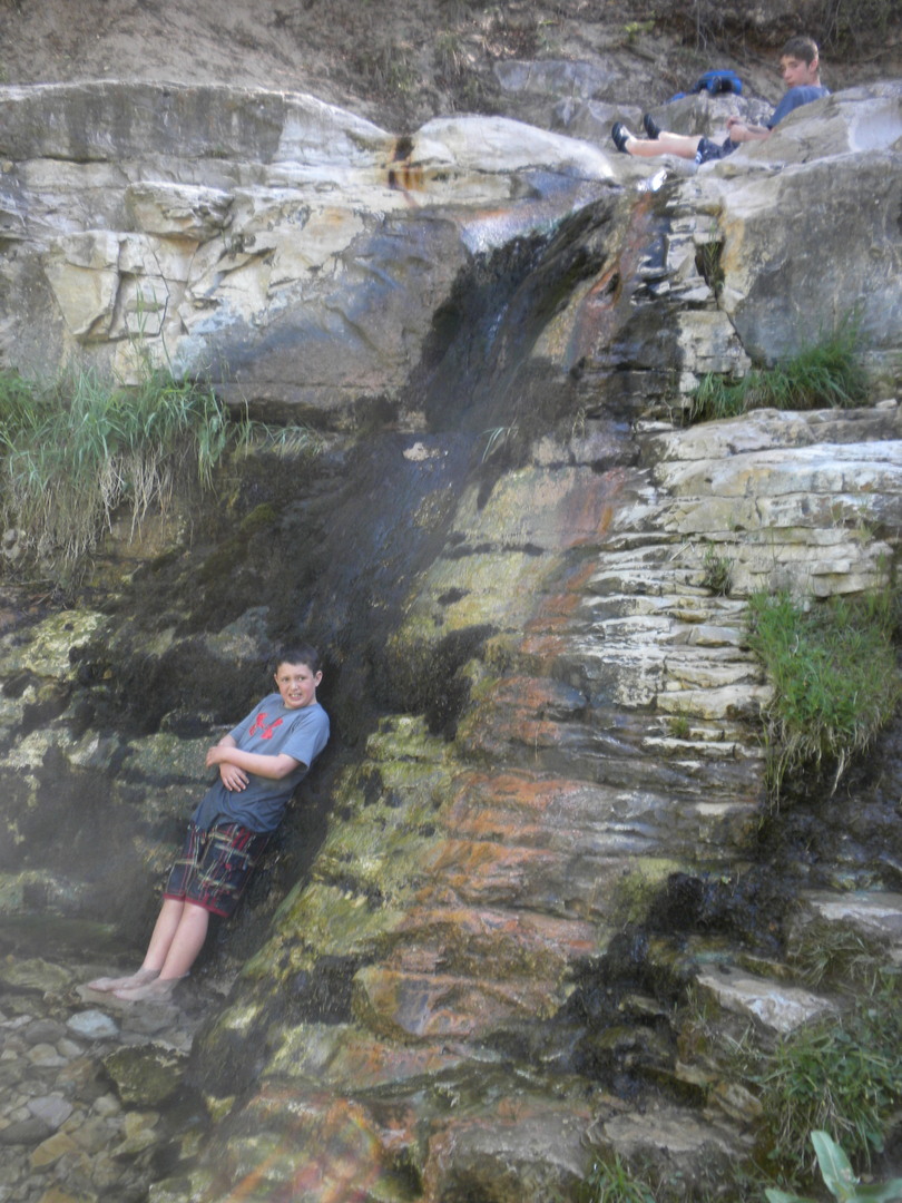
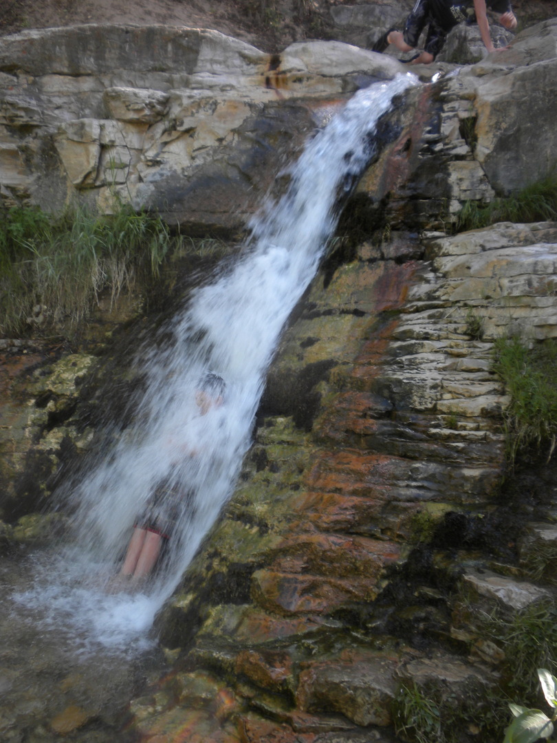
Cold and clear, the Jones Creek rushes down to meet the Green River passing through the famous “Butt Plug Falls” where one can sit in the creek, stop the water and then release it by standing up.
After our meal we gather around our only campfire for songs by Stephanie and Nick : Poor Girl Blues, Folsom Prison Blues.
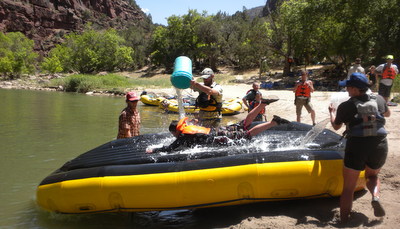
Day 4. The plan was to arise early, load up and complete the last leg of our trip – 18 miles with a couple of significant stretches of rapids. I paddled along with Mike, Pam Kathryn, Jim and Patina. In the rapids Stephanie purposefully aimed for the waves to soak Mike and/or I in the front of the paddle boat.
Eric rode in the oar boat with Nick and David. We had buckets and there was a lot of splashing and soaking of victims in other boats.
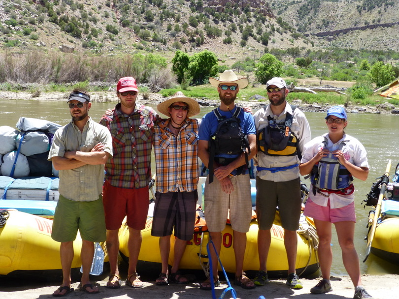
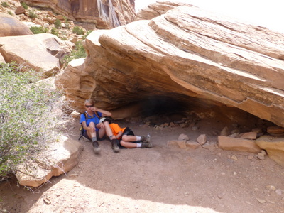
In Island Park the river opens up into a large valley, meandering around a large group of islands with views of the Uinta Mountains and Split Mountain. We passed the Rainbow Park boat ramp and stopped for lunch at the Echo Park Dam site. After a morning of flat water, we pick up speed as we enter Split Mountain Canyon and the river’s gradient becomes considerably steeper. As we got into more white water the bucket wars stopped. Four or five major rapids delivered plenty of whitewater excitement during our last day on the river: Moonshine Rapid, S.O.B. Rapid, Schoolboy Rapid. At the takeout was a cave where reportedly Butch Cassidy and The Wild Bunch hid saddles and guns. We hit the takeout exactly at 3pm as Russell had predicted. The guide crew posed for a final picture: Hunter, Nick, Russell, Matt House, Mattie and Stephanie.
At the Split Mountain boat ramp we reached our take-out point and took a short ride back to Vernal, arriving at 4pm. We unloaded our gear, checked into the Best Western Antlers and hit the showers and pool. Dave Skinner and the twins joined us for dinner. Eric and the twins shared a pizza and we all had a good time.
Saturday 6/22. We met several others from our party at JP’s Breakfast before heading out to Nine Mile Canyon with Helmers following us. Skip and I led in the Ford Focus while Jim, Pam, Eric and Kathryn followed. Our northern approach from Myton was initially denied with a “Road Closed” sign that Skip and I chose to ignore. Following the Garmin left us jumping irrigation ditches in an alfalfa field so we back tracked and got route confirmation from a passing oil field worker. The drive through the upper section traversed oil rigs and we didn’t see as many petroglyphs in the lower canyon as previously expected.
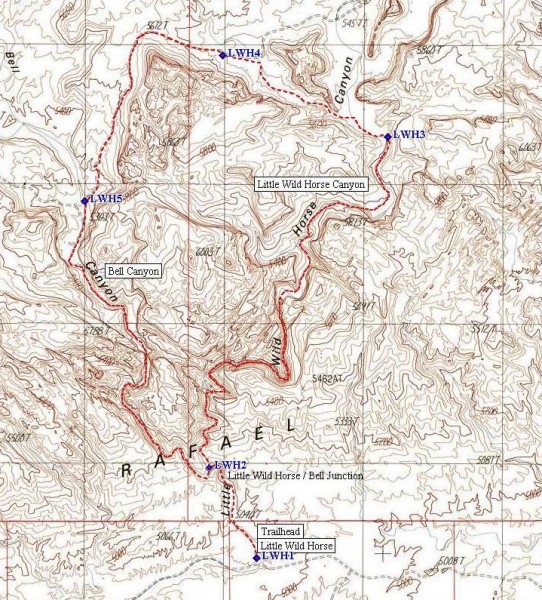
At the end we split up with Helmers driving on to Moab and we set up camp in Price for three nights as we explored the upper portion of San Rafael Swell. The San Rafael Swell is a unique kidney shaped uplift in the center of Utah that has been eroded down and cut with interesting canyons. The “Swell” is about 50 miles in length and 30 miles in width. Only one paved road crosses through the approximately 600,000 acres, Interstate 70. The East and West oriented freeway carries traffic directly through the center of the Swell, bisecting it into the Northern and Southern halves. We visited Buckhorn Draw, hiked Pine Canyon and had lunch the Wedge Overlook.
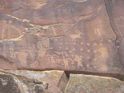
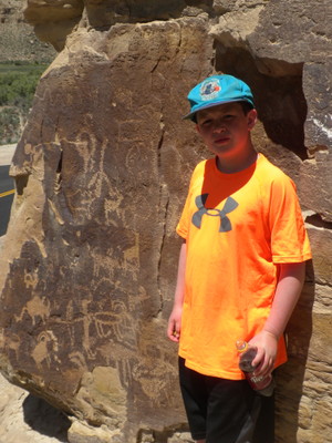
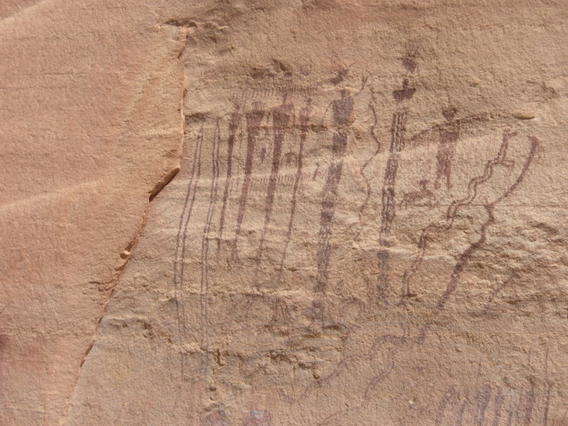
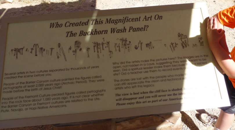
Monday 6/24. We drove the Buckhorn Draw to the San Rafael Swell. Once the scene of outlaw chases, Buckhorn Draw (a long, steep-walled canyon), is the main northern gate-way to the Swell. A highlight is the Buckhorn Draw Native American rock art site. The Barrier Canyon people lived in this area 2,000-10,000 years ago. As they passed through Buckhorn Wash, they painted colorful images on a large cliff face. Other native groups added other images. Painted over a 160-foot-wide rock canvas is the Buckhorn Wash Pictograph Panel. The panel is thought to be about 2,000-6,000 years old and created by the Western Archaic Culture. The Buckhorn Wash Rock Art Panel has been restored and they have virtually eliminated the vandalism. They even have sign with photos of before and after. The panel is worth a visit.
Pine Canyon. Skip and Beth hiked out with the Pine Canyon Overlook as their destination while Kathyrn, Eric and I trailed along behind. It wasn’t long before Eric had a major meltdown; it was too hot, too far, and he didn’t feel well. It was too hot….temperatures were in the 90s; so we proceeded to hike shady spot to shady spot and cruise along at a comfortable pace.
Pine Canyon was rough and rugged. We returned to the car for cold sodas and sat in the shade until Skip and Beth returned.
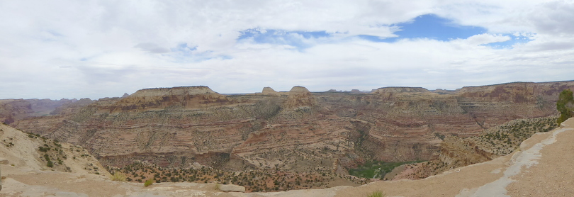
The Wedge Overlook provided a striking view of the Little Grand Canyon, the San Rafael River, and the Sid’s Mountain Wilderness Study Area. There are picnic tables, restrooms, and camping areas available at this facility, but like elsewhere in San Rafael Swell, no water. To the South, across the canyon, is the remote Sid’s Mountain Wilderness Study Area, while the view down canyon towards the Southeast takes in Window Blind Peak and the Southern Buckhorn Wash area.
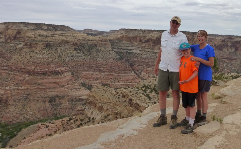
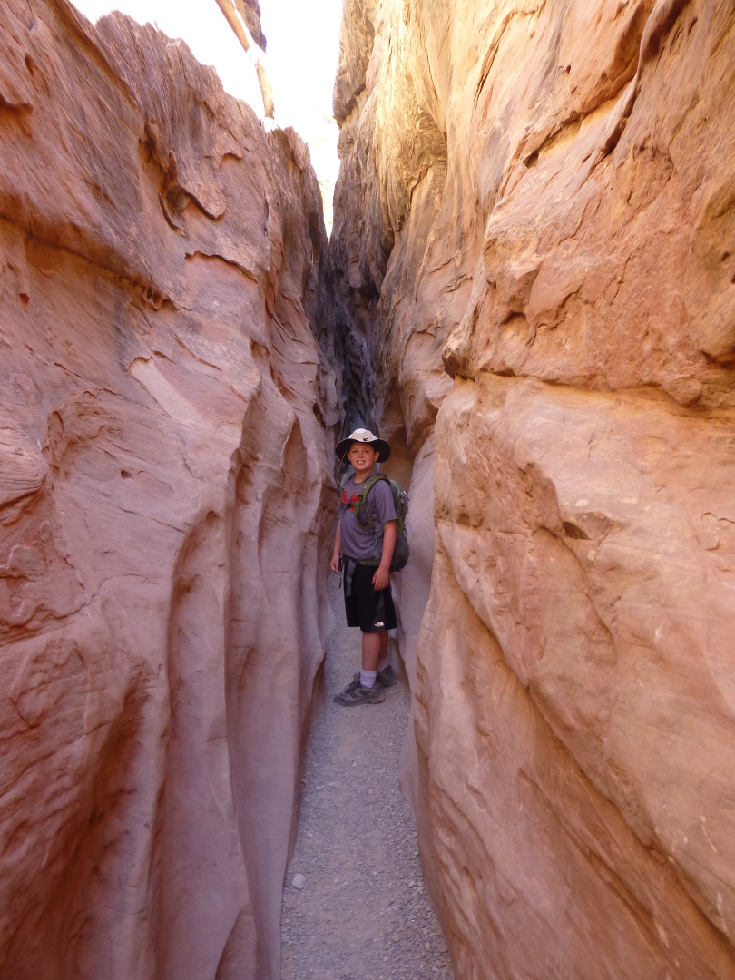
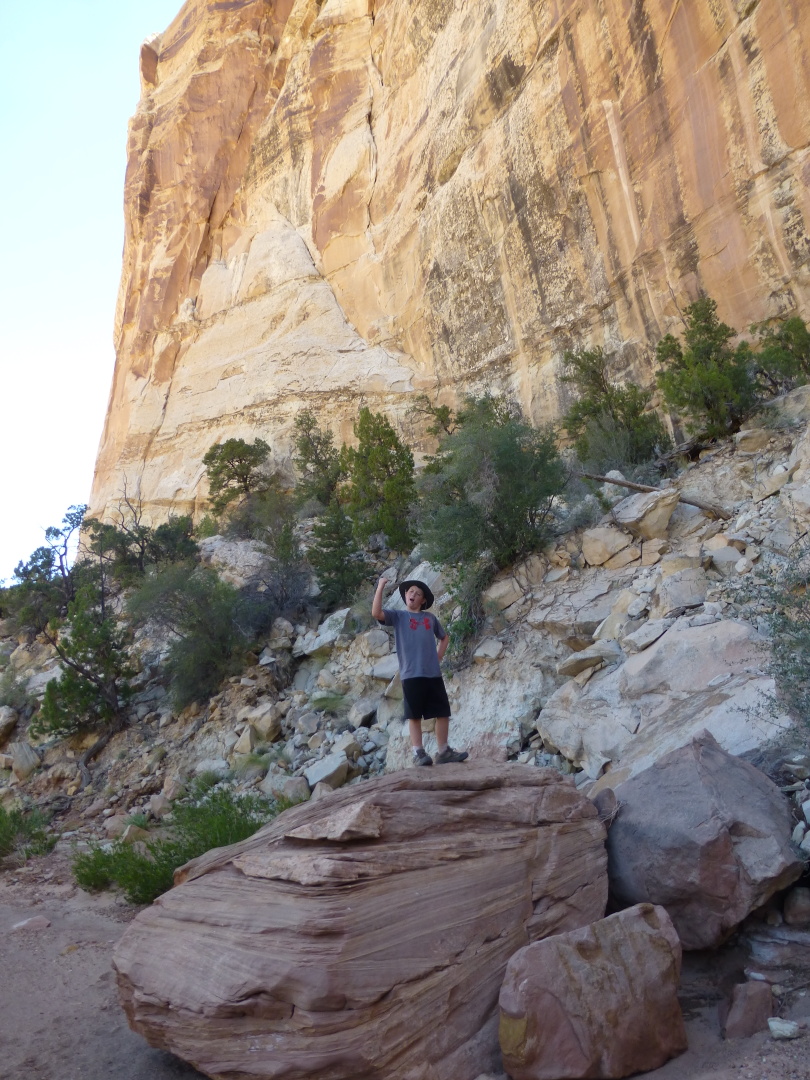
Tuesday 6/25. The Little Wild Horse Canyon/Bell Canyon loop hike are spectacular slot canyons just outside of Goblin Valley State Park. This is the most popular hike in the San Rafael Swell as the canyons are two of the best slot canyons in Utah with twisting high walls on either side, sometimes only a few feet apart in the amazing narrows. The Little Wild Horse Canyon/Bell Canyon loop hike is 8 miles round trip. Kathryn, Skip and Beth did the entire loop while Eric and I hiked up and back in the slot canyon pausing frequently in shady spots for games of pitch. Our favorite stop got overtaken by a large church group that gave several testimonials to the background noise of shuffling cards. The timing to return to the car worked out nearly ideal.
Wednesday 6/26. Skip and Beth planned to hike Wild Horse Canyon as an up & back, but got lost, didn’t have a watch and didn’t return to the car until much later than expected. We were creative about wasting our time; climbing rocks and making echos. It was a long, hot, uncomfortable wait back at the car.
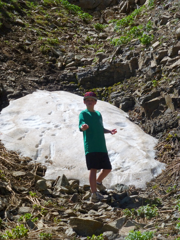
Thursday 6/27. We left Green River for Hanksville were we stopped by the BLM office at 9am to validate our planned traverse across the Henry Mtns. Eric was surprised to see a snow bank on the hillside by the road.
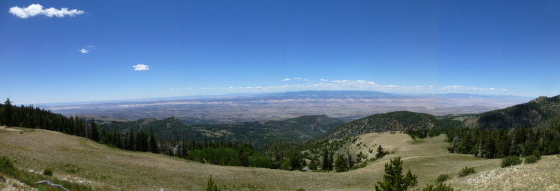
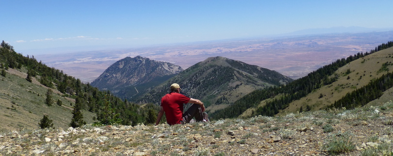
We drove up the dirt roads of the Henry Mtns stopping at Bull Creek Pass for lunch.
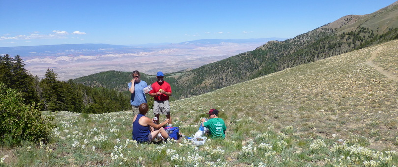
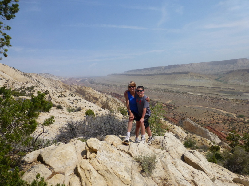
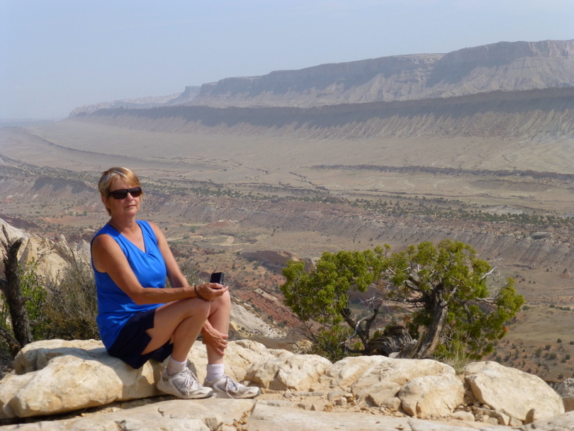
Kathryn, Skip and Beth hiked part-way up Mt Ellen. Everyone enjoyed spectacular views. We could see smoke from forest fires in Colorado and had an outstanding view of the WaterPocket Fold in Capitol Reef.
Friday 6/28. We stayed in Torrey just outside of Capitol Reef National Park. Capitol Reef is named for capitol for the white domes of Navajo Sandstone that resemble capitol building domes, and reef for the rocky cliffs which are a barrier to travel, like a coral reef.
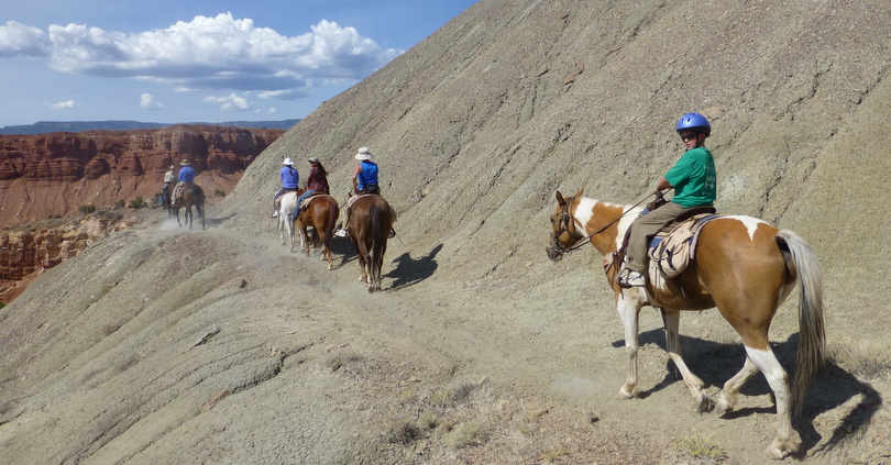
Kathryn arranged for a 1/2 day trail ride from Hondoo. (Jim|Ben, Kathryn|Willy, Skip|Dante, Beth|Oscar and Eric|Wailing); plus co-owner Pat and guides Colin and Rachael. The horses were great; well behaved and responsive to leg yields. Eric did great and asked to buy his horse. Below Kathryn and Eric head up hill.
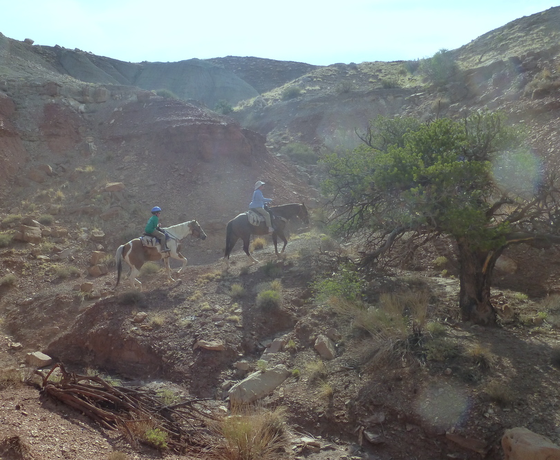
Pat, Skip, Beth, Rachael, Kathryn and Eric traverse a bank.
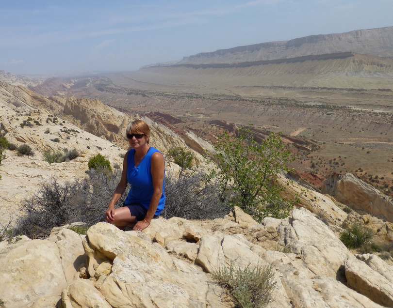
Saturday 6/29. We departed at 7am and drive to Upper Muley Twist. Kathryn, Eric and I hiked to the Strike Valley Overlook while Beth and Skip hiked Upper Muley Twist, but they were unsuccessful in finding the trail to the overlook ridge.
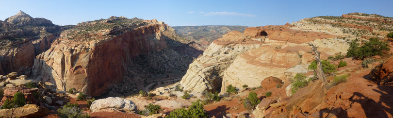
Utah’s WaterPocket Fold is one of my favorite places. The Waterpocket Fold defines Capitol Reef National Park. A nearly 100-mile long warp in the Earth’s crust, the Waterpocket Fold is a classic monocline: a regional fold with one very steep side in an area of otherwise nearly horizontal layers. A monocline is a “step-up” in the rock layers. The rock layers on the west side of the Waterpocket Fold have been lifted more than 7,000 feet higher than the layers on the east. The Waterpocket Fold formed between 50 and 70 million years ago when a major mountain building event in western North America reactivated an ancient buried fault. When the fault moved, the overlying rock layers were draped above the fault and formed a monocline. More recent uplift of the entire Colorado Plateau and the resulting erosion has exposed this fold at the surface only within the last 15 to 20 million years. The name Waterpocket Fold reflects this ongoing erosion of the rock layers. “Waterpockets” are basins that form in many of the sandstone layers as they are eroded by water.
We returned to our hotel via Scenic Byway 12 through the Dixie National Forest and along the east flanks of Boulder Mountain. Scenic Byway 12 climbs to an altitude of more than 9,000 feet.
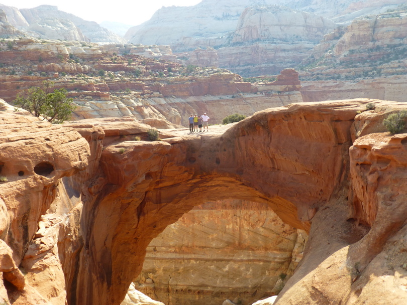
Sunday 6/30. Sunday morning we again departed at 7am to avoid the heat and climbed Cassidy Arch. Named after the famous Butch Cassidy, the arch is located just within the western walls of Grand Wash, beside the Scenic Drive. The arch is large and spectacular and photogenic at almost any angle. The first part of the trail gains elevation very rapidly and has several switch-backs. The trail is in good condition; rock stairs have been constructed at steep portions, and rock cairns mark the way when the trail is not visible. The trail ends on top of the Arch, situated about 500 feet above the trail head below.
Monday 7/1. We visited Calabas and some other outlet stores on our drive to the airport. We had a late flight home.