Tag Archives: camping

Spanish River

2015-07-31 Spanish River

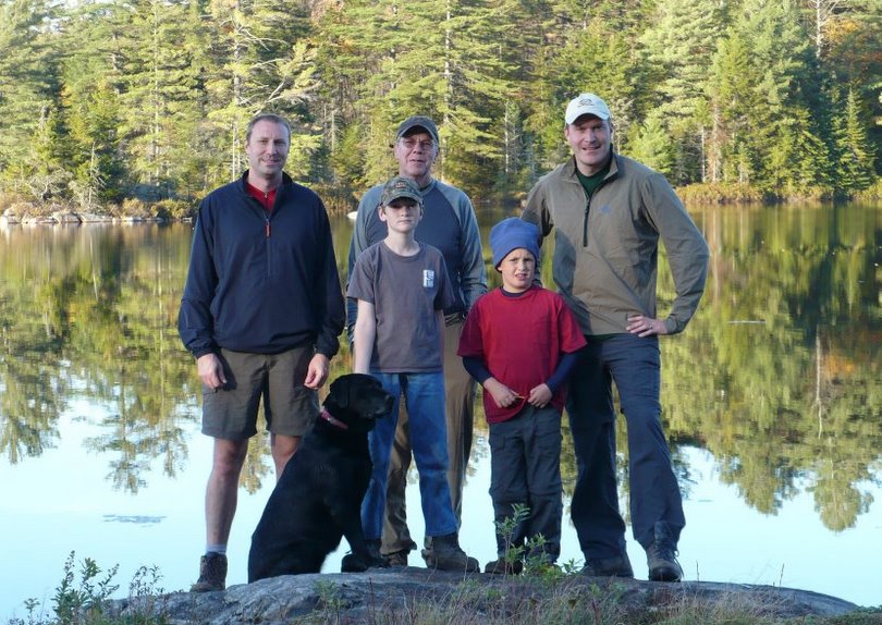
During our 5 day trip down the Spanish River Skip had several ‘songs’ composed in his honor.  It gave Jim something to do while paddling and proved mildly entertaining to the rest of the group.  There were variations of Canoeing in the Rain, and 99 Bottles of Beer on the Wall (became 30km to Paddle Today) and this summary of the trip.

Spanish River 2015 (with apologies to New Riders “Henry”)

Every year about this time we plan a canoeing trip,
bringing all our canoeing buddies the group is led by Skip.
Heading north to Spanish River, there are sights to see,
paddling down those Spanish rapids, classes II and III.

The Spanish landscape is beautiful and a wondrous sight,
we saw ducks, ospreys, moose and the full moon at night.
But the lure of the river was running down those waves,
we ran all the rapids except those named as graves.

Now we’re paddling the Spanish River going fast splash, splash;
if we dump at this one it will be our last.
Paddling Spanish rapids, classes II and III;
help me keep this canoe straight through these rapids if you please.

Paddling down Spanish River for all of five days
Skip consulted all the maps we thought he knew the way.
Lakes and swifts and rapids, the water ran downstream
We paddled 30 kilometers every day ‘cause Skip was mean.

Bouncing off the rocks and boulders paddle Steve and Ski,
Following right behind them paddle Tim and me.
Jack is ruddering, Skip is prying, trying to keep them straight.
At the bottom of the rapids we will quietly wait.

Now we’re paddling the Spanish River going fast splash, splash;
if we dump at this one it will be our last.
Paddling Spanish rapids, classes II and III;
help me keep this canoe straight through these rapids if you please.

Now it’s looking dire for our boys and their sideways canoe,
They are floating towards the rocks and we don’t know what they’ll do.
Watching beers and chocolates floating down the waves.
Leaving Jack and Skip alone, it’s snacks and beers we’ll save.

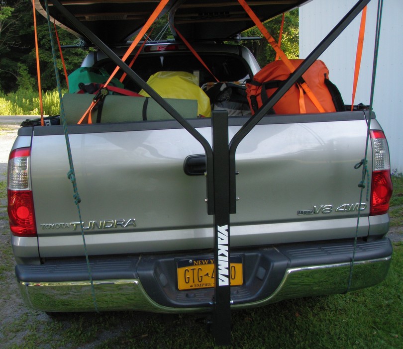
Friday before departure Eric and I assembled the Yakima racks for my truck; a vex some process, but it enabled us to carry most of the gear, two canoes (Wenonah Cascade & Old Town Camper) and three passengers.  Tim drove his Jeep with his gear, Steve’s Mad River canoe and three passengers.

OLYMPUS DIGITAL CAMERA

We met at my house at 7am and were on the road by 7:30am – headed to Buffalo, Toronto and NW to Agnew Lake Lodge.  Toronto was hosting the Pan American games and traffic was unbelievable.  We lost 1 hour in heavy stop and go traffic and almost got rear ended.  We stopped in Perry Sound (home of Bobby Hull) due to a traffic accident. We overheard the accident lawyer, who was a famous florida accident attorney,  say that the accident had killed 2 and left 4 others injured. It seems this location is no stranger to local injury attorneys.

To the other side, another personal injury lawyer was assimilating the grim scene on the accident spot. We call Agnew Lake Lodge and informed them we would arrive the next morning instead.  We rented a campsite and turned in at 9pm.  We arose Sunday at 5:30am, packed up and drove to Agnew Lake Lodge.

Google Directions to Lake Agnew

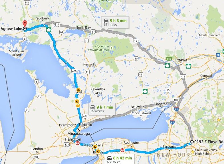
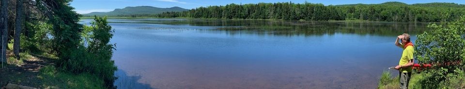
At Agnew Lake Lodge we got our shuttle drivers, fishing licenses, camping and parking permits and headed to Duke Lake – a three hour drive.  We were on the water at 1:30pm and headed out looking for an early campsite.

2015-07-31 Spanish River

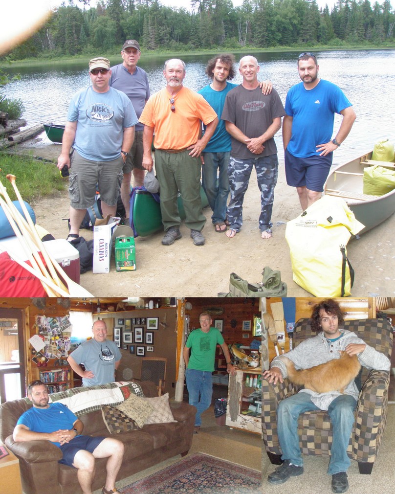
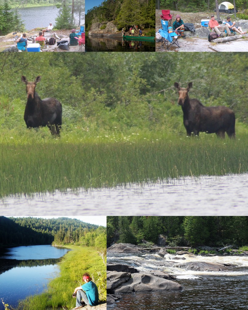
We camped on a sandy point after paddling on 9th Lake for a little over 2 hours.  We were hopeful the exposure on the sand spit would provide a breeze and keep the bugs away.  It did, occasionally.  We had some mosquitoes, but mainly biting flies – stable flies / ankle biters.  We all took a quick swim to clean up but didn’t stay in long due to the leeches.  We agreed that each of us would be responsible for our own breakfast and lunch but we took turns making dinner.  For the 1st night Steve made turkey meat burritos for dinner.

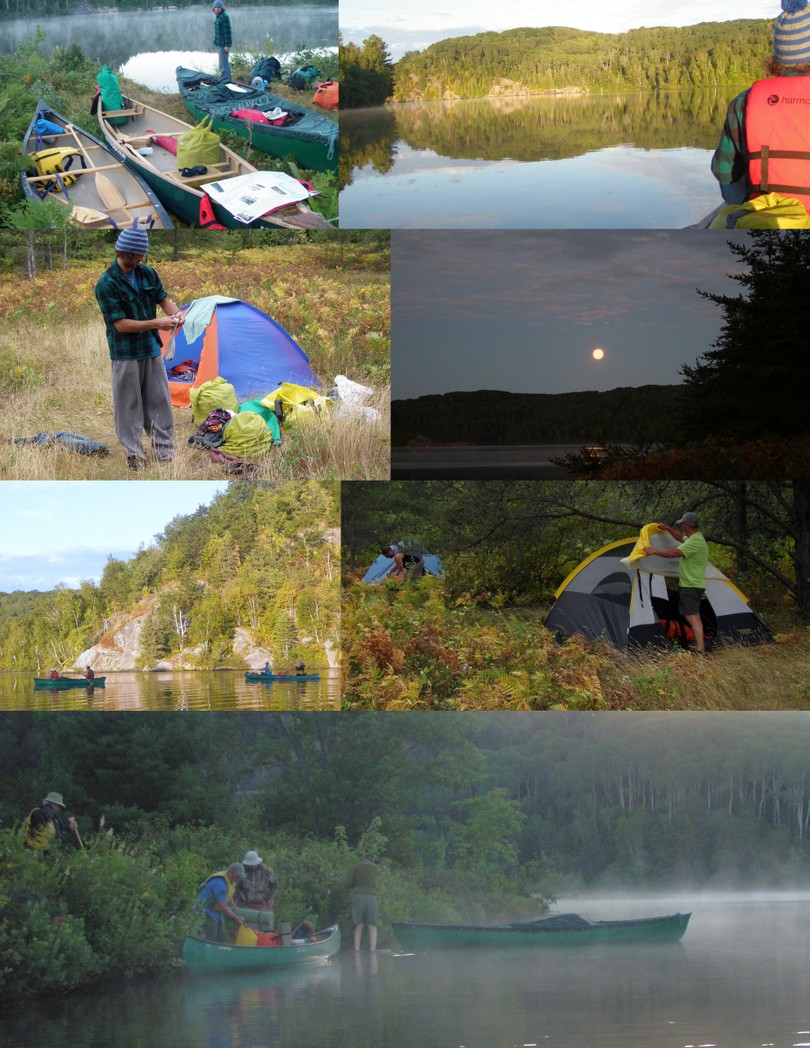
I slept OK – not great.  I overfilled my NEOS air Eva King Size and it was hard, but my charcoal pillow gave relief, though. We had mosquitoes in the tent and I had to get up to pee.  We got up at 6pm.  Skip made coffee and eggs.  We packed up our tents, damp with condensation and were paddling by 8am.

2015-07-31 Spanish River1

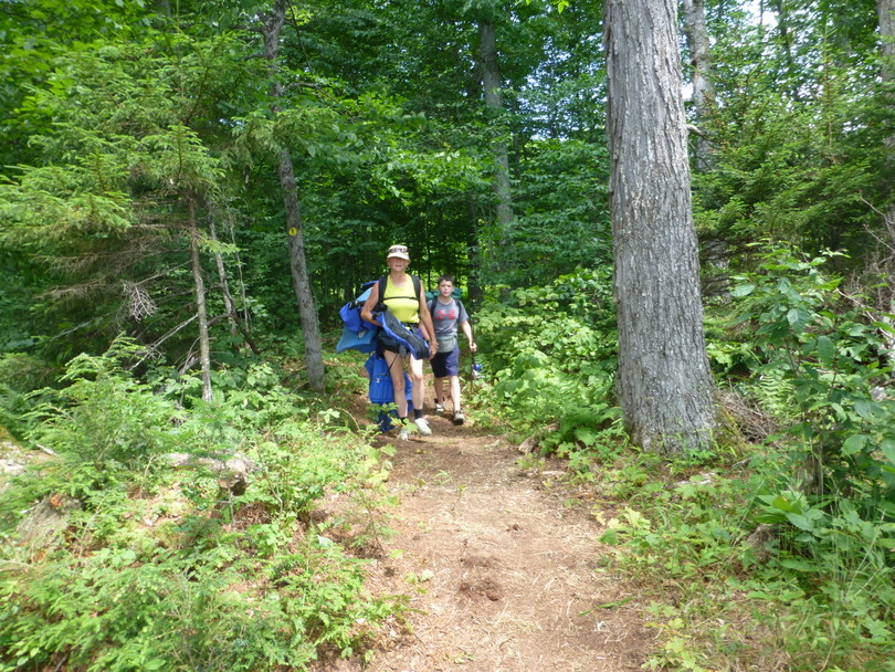
Our routine was to paddle for 60-90 minutes and then stop for a drink and snack.  Skip’s plan was to get us to the head of Agnew Lake on Thursday night so the paddle across the lake could be done early Friday morning while the lake was calm.  To achieve this he set paddling goals of 10km on Sunday and 30km every day thereafter.  We paddled from 8am – 3pm – all lake paddling with a couple of little swifts in between. Leaving 1st Lake we followed a series of swifts and easy rapids.  Tim and I put our canoe cover on as we left our lunch site anticipating rapids.  Tim and I went 1st through the first rapids we encountered.  Skip and Jack went next; followed by Steve and Ski.  There was a large rock towards the bottom of the rapids.  Skip and Jack tried to cross to the right side of the stream and broadsided the rock and dumped.  They used the home made bailer I issued to each canoe to empty the water from their boat – it would be used again.  Tim and I saved the beer and chocolate which escaped their canoe.  We took pictures at one of our break points that coincided with a campsite that Skip, Steve, Bob and I had used as our day 1 campsite on our trip 12 years prior.  It was more overgrown by bushes.   We fell just short of Skip’s goal for the day when we decided to stay on a point in Expansia Lake.  Skip and Jack made dinner: steaks, potatoes and fried squash.

2015-07-31 Spanish River2

Our water filter got clogged despite our pre-filtering of the lake water.  We back flushed multiple times and got minimal improvement.  Tim declared out Expansia Lake campsite to be ‘Squatchy” and claimed to hear several Sasquatch noises.

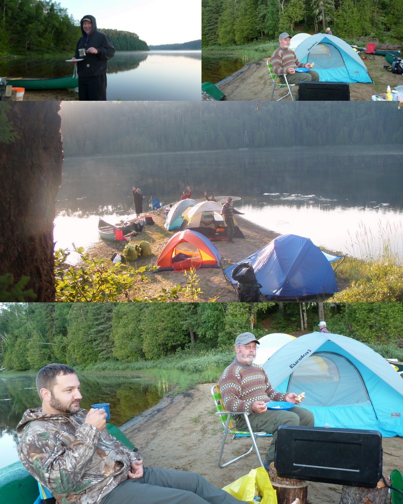
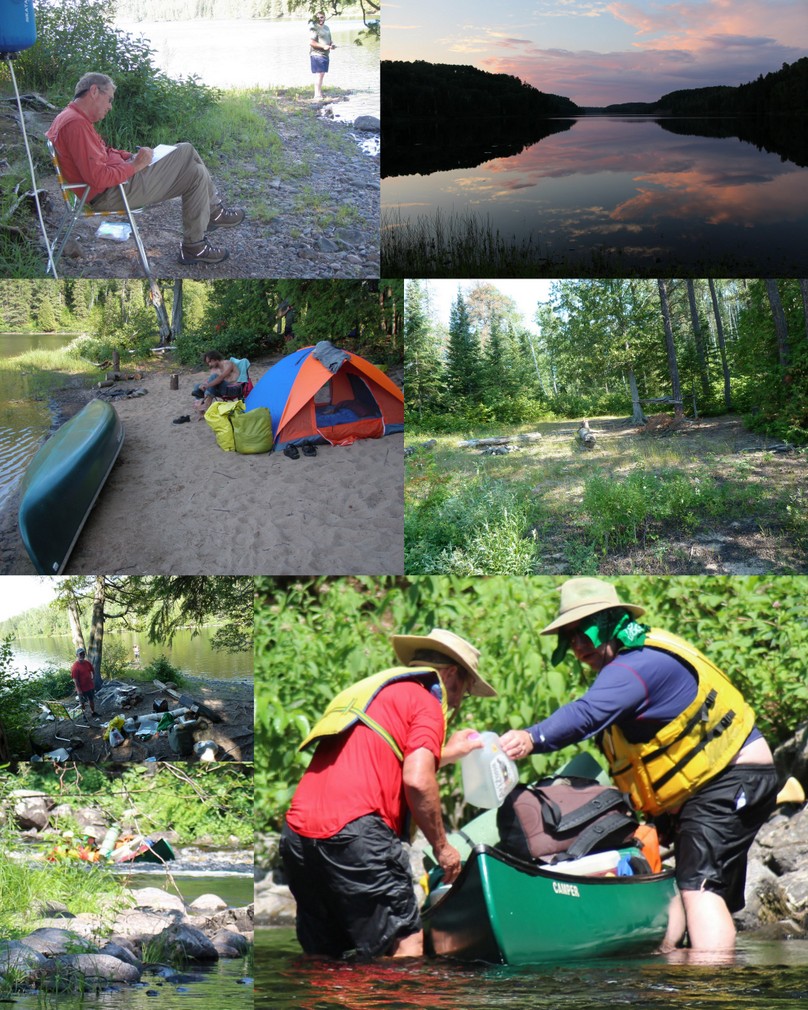
Our 3rd day was a marathon day of paddling from 8:30am – 6:30 pm with a one hour break to portage around Upper Albion Rapids.  We ran the Lower Albion Rapids, Railroad Rapids, Bridge Rapids and Cliff Rapids.  We were going to stay at Cliff Rapids but the 1st site was too muddy and dark.  We ran the rapids (past the nude sunbather) and found the lower two sites were taken.  About 3pm we stopped at an old campsite and Jack, Tim and I went for a swim to cool off.  I felt like I was overheating and needed to cool down.  About 4km below Cliff Rapids we found an island campsite where we stayed for the night. It was buggy, but home for the night. Tim and I made carrot sticks and celery sticks stuffed with peanut butter or cheese spread as our snack and cooked hot dogs and beans for our dinner.  Jack & I took a swim off a nearby sand bar after dinner but the hordes of large horse flies were a menace and kept us from being out long.

2015-07-31 Spanish River3

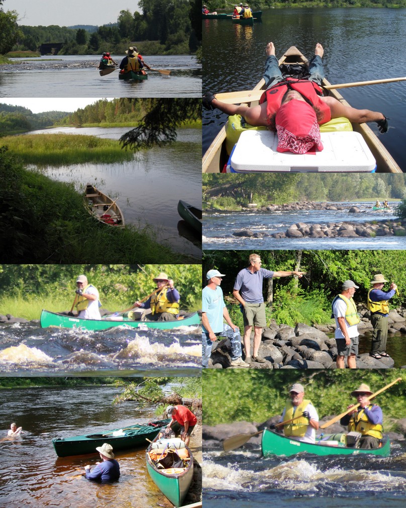
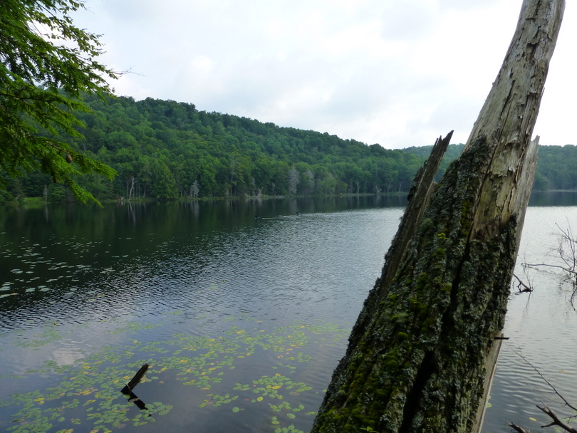
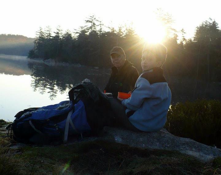
We were on the water at 7:30am and paddled Zig Zag and Little Graveyard rapids.  We emptied the boats and carried around Graveyard Rapids.  At Agnes Rapids, Skip & Jack carried, Tim & I lined and Steve and Ski ran.  We played leap frog with a family group who stopped to swim at the Elbow.  One of the swimmers lost their Croc while swimming.  Tim and I managed to retrieve it from the fast moving water and toss it up on shore for them to retrieve.  We saw two moose swimming across the river and they stood on the shore and watched us approach for a long time.  We stopped to camp for the night on top of a very large rock with an outstanding view although it was a pain to haul our gear from the canoes up the slope.

Our water filter has failed.  It has gradually slowed down to the past few days we have had to back flush every 16-32 oz.  We finally got enough water by letting it drip all night long into the big collapsible water bucket and by using the water from the 1/2 gallon ice blocks which melted.  I also had 2 dromedary bags filled with water from melted ice.  It was nice drinking clean water that we didn’t have to add Crystal Light flavoring.

Wednesday night I made Spanish rice  using Kathryn’s recipe and preparations.  It came out great and everyone had 2nds and 3rds.

2015-07-31 Spanish River4

Thursday morning we were on the water at 8:15am, ran a couple of swifts and then ran the Cascade Rapids.  Cascade Rapids were a series of ‘cascades’ with the last of the rapids being large standing waves.  Tim got a chestful of water, but little made it’s way into the canoe.  The canoe cover worked well.  It was easy to access the snaps stayed on and it shaded our lower legs and feet.  It saved us on at least two occasions from getting serious water in the canoe. We paddled until 2pm and camped at the head of Agnew Lake.  There was a lot of wind and white caps as we set up camp.  We staked our tents down securely and enjoyed some camp time.  Skip and Jack made dinner from freeze dried vegetables and rice.  Bored by 6pm we turned in early at night. We were once again blessed with a full moon at night.  We got up early, had coffee and granola bars and packed up for our paddle across Agnew Lake.  The lake was dead calm to start, but we ended up paddling into waves on our return.

Spanish River Last Day Collage

On our return ride home (13 hours !!) we had plenty of time for trip assessment discussions.

  • The Spanish River was a good choice for our skill levels.  The Class II & III rapids were challenging but not threatening.  Both Tim and Jack, as well as the rest of the group, gained more confidence in running rapids and maneuvering the canoes around obstacles as the trip progressed.
  • Traveling with 6 people / 3 canoes was ideal.  The group fit the available campsites and we all traveled at a similar pace.
  • The truck and Jeep were ideal for transporting 3 canoes, gear for six people and six passengers.
  • The Mad River and Wenonah Cascade canoes were well suited for the trip.  The canoe cover was a nice feature.  The 16′ Old Town Camper canoe lacked a little freeboard in the middle and that’s where Skip & Jack shipped most of their water.  Bailers for each canoe were useful.
  • Despite planning a 6 day trip the group decided to try and return on Saturday.  We spent 1/2 day on the water Sunday; Monday-Thursday as full days on the water and 1/2 day out on Friday.  While a little more “down time” would have been appreciated on a couple of the long days paddling when given the extra time on the last day we got bored.
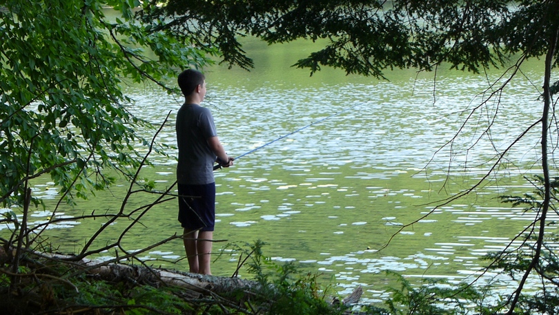
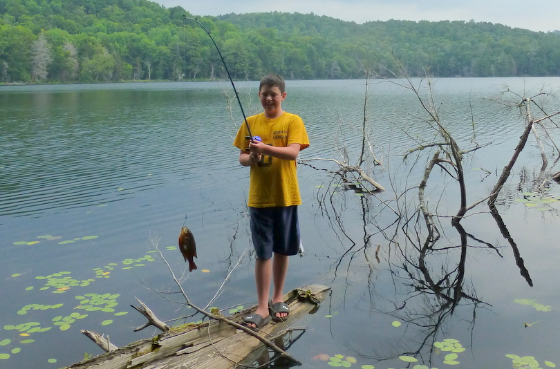
  • Despite planning to fish the group didn’t invest as much time in fishing as perhaps planned.  Even with a license and bringing fishing equipment Jim never fished at all.  Steve and Ski did the most fishing, but much of that was trolling while paddling.
  • The next trip should have a ‘transportation officer’ responsible for road maps and alternative routing to/from our destination.  We relied too heavily on our GPS which routed us through Toronto and heavy traffic.    The drive to/from Agnew Lake Lodge was excessive.
  • Our water filter issues were troublesome.  We had another Basecamp filter and a small emergency Sawyer water filter if needed.  We did multi-layered pre-filtering of our water, but probably should have let our water settle in the camp bucket for 10-15 minutes before pre-filtering.
  • Our meals worked out great and we had an abundance of food and snacks. The two burner propane stove worked out well.  We agreed next time that the cooks shouldn’t also be responsible for washing dishes.  We should have squeezed our food supplies to reduce  from 4 to just 3 coolers.

Plans for a summer 2016 trip are being considered.

1st Weekend of May

Kathryn (and Scout) did an solo overnight canoe camping trip to Moss Lake on Thursday / Friday.

P1060441

Friday Eric was home sick with a sore throat.  In the afternoon I got our riding lawnmower fired up and did a 1st time mowing of the lawn.  Saturday we cut trees along the meadow.  Kathryn sprained her ankle and got Hawthorne thorns in her leg.  I got a wagon load of manure from Weslie Hughes for the pumpkin patch and planted tomato plants in the garden.

Essex Chain of Lakes

The Essex Chain Lakes Complex is comprised of the 19,600 acres of lands and waters of the Essex Chain Lakes Primitive Area  located in the central portion of the Adirondack Park.  Essex Chain Lakes  were acquired by the state in 2012, opened to the public officially October 2013 and made accessible for camping in June 2014.  Thirteen designated tent sites along the shores of the waters of the complex require a free permit between May 15 and October 15.  The permit system is administered through a partnership with the Student Conservation Association Back Country Stewardship Program and SUNY College of Environmental Science and Forestry’s Adirondack Interpretive Center (AIC) facility.  Campers must call 518-582-2000 or visit the AIC facility at 5922 State Route 28N in Newcomb, NY, to reserve a tent site. Campers can pick up their reserved permit at the AIC facility between 9 a.m. and 7 p.m. any day of the week. Tent sites may be reserved no more than 10 days in advance.  Campers may visit the AIC web site  ( http://www.esf.edu/aic/ ) for maps and information about camping, the tent sites and the permit system. The AIC website will track tent sites that are occupied or reserved to assist campers in choosing a campsite.  The camping is restricted — no campfires — as these campsites are located in what are the Essex Chain Lake and Pine Lakes Primitive areas. More campsites are in the works with fewer restrictions in other areas.

Essex Chain of Lakes Campsites

It’s about an 11-mile drive from Rt. 28N to the Deer Pond parking lot. Take the Goodnow Flow Road approximately 4.3 miles and turn right onto Woody’s Road. Follow Woody’s Road for approximately 1.5 miles. Turn left onto the Cornell/Deer Pond Road and travel 4.4 miles to the Deer Pond parking area.  The first seven miles are through private land until you reach the new Forest Preserve boundary. From there, it’s another four miles on a dirt road. A car with good clearance can make this trip under current road conditions.

Essex Chain of Lakes Access

essex-chain-lakes-sign

Much of the portage trail is old  road which can accommodate a wheeled cart.  Paddlers can carry their canoe or kayak from the parking area at the end of the Cornell/Deer Pond Road less than 0.25 mile to Deer Pond.  Below Kathryn and Eric arrive at the Deer Pond launch site.

P1050135

The 0.5 mile carry from Deer Pond to Third Lake is located directly across the pond on its southern shore.  Once in Third Lake paddlers can access Second Lake by water and from there travel to First Lake using a short carry trail. On the northern shore of First Lake near its western end is the 0.4 mile carry to Grassy Pond.

We chose  the other direction and traveled from Third Lake to Fourth Lake and then to Fifth Lake can be reached by paddling through the culvert under the roadway, or during high water portaging over the road. Paddlers can reach Sixth and Seventh Lake directly from Fifth Lake.  We chose to camp at the only site on Fifth Lake assuming seclusion but were unaware of the dirt road passing behind the campsite.  On our 1st day there were bikers and one lost hiker.  The campsites were a little rough but the lake was pretty.

Eric worked hard at fishing and was finally rewarded when Kathryn suggested he use pieces of hot dog near the downed tree.

P1050142

Eric caught 25+ sunfish and shiners (some possibly more than once).  Kid fishing at it’s best.

P1050180

We toured Sixth and Seventh Lakes on Tuesday evening.


P1050153

Matt and Skip

P1050160

Generally good weather, although rained one day. Bugs were not bad except for deer flies on the portage.  We heard and saw lots of loons; swimming, fishing, flying from pond to pond and making defensive displays to distract Skip and Matt when they inadvertently got too close to a family unit.   At least 5 of them  swimming, dancing and flying past our campsite all the time.  Very cool.  Heard owls and various warblers.  Because the campsite hadn’t had a lot of use (we think we were actually the first), no black bears in evidence.  Leeches in the water were a deterrent to a lot of swimming, though we did swim some and the water was very warm.


P1050171

Kathryn doing a little tent house-keeping.

P1050163

After breakfast Wednesday morning Matt and Skip hiked out to the parking lot;  Matt to return home and Skip to meet his brother-in-law, Steve.  Skip and Steve paddled around the Chain of Lakes Rain.  Mid-afternoon rain moved and we sat under the tarps and played cards and cooked our dinner of Mac & Cheese and hot dogs.  The evening cleared out and the next morning displayed a clear and calm Fifth Lake.

P1050192

Thursday morning we opted to portage out along the road rather than paddling back to Third Lake.  It took about 60 minutes of easy walking.

Sacandaga Headwaters 30-Mile Canoe Route

A paddling tour of the southern Adirondacks. This is not a pure wilderness route, as most of it is a front country tour of Piseco Lake, Sacandaga Lake and Lake Pleasant. At the same time, there is plenty of wilderness paddling required to connect the three big lakes. It so happens the position of Piseco, Sacandaga and Lake Pleasant in the southern Adirondacks can be linked together with several streams, smaller lakes and two canoe carries, to make a multi-day, 30 mile canoe route.

After a rendezvous at Speculator we put-in at Piseco Outlet (a.k.a. Big Bay) along Route 10 on Friday morning, after leaving a vehicle at Duck Bay on the Sacandaga River off Rte. 30, south of Speculator. We put in and began paddling at 10am. With unusually low water levels we had to line the canoe through the rocky elbow of Big Bay. Calm conditions allowed us to easily paddle across 5-mile length of Piseco Lake past three state campgrounds.

From Piseco Lake we entered Fall Stream and headed to Vly Lake. Fall Stream is passable by small watercraft from the Old Piseco Road to Vly Lake and is used for canoeing, fishing, hunting, and trapping; in addition to providing access to Fall Lake and Vly Lake. The meandering narrow stream bed winds across a broad, marshy area with the terrain consisting of low rolling hills, traversing through a picturesque marsh for most of the trip with occasional beaver dams to carry over. Apart from a two docks just past the put-in, Fall Stream is undeveloped.

We portaged around the short section of rapids (about 50-60 feet long) under the bridge and took a break for lunch at the put-in. We watched 3 kayakers and one tandem blue canoe launch and head upstream in advance of us. We also saw a small pickup truck in the parking lot that probably held a car top fishing boat. We paddled up Fall Stream passing over two large beaver dams to Vly Lake. A large dead fall had been recently cleared with a chainsaw so it posed no obstacle. We met up with the three kayakers at the 2nd large beaver dam and stopped to chat with two fisherman exiting Fall Stream in their fishing boat. They reported catching several pickerel on their fishing trip. They had a chain saw and had been responsible for clearing out the dead-fall.

A two primitive tent sites are located on Vly Lake which is a beautiful, isolated spot. The lake is surrounded by mountains with Vly Lake Mountain right on the eastern shore. We reached our campsite on Vly Lake at 2:30pm. Above Vly Lake, Fall Stream becomes narrower and the number of obstacles increase.

The last time I had visited the Vly Lake campsites the western most campsite had been “improved”. It had a an old canvas chair, a gas barbecue grill sans the gas tank, two flag poles, a half buried 5 gallon bucket (clean and 1/3 full of water), and a lot of garbage. The last residents had left a smoldering fire and left toilet flowers all over the woods. They had cut a large spruce tree off at 4′ that was apparently obscuring their view and dropped it into the lake. They dumped crackers on the ground, burned their cans in the fire and dumped beans on the ground. We ended up taking 2 bags of trash out with us on Saturday.

On this trip the campsite was clean. We hung out for the rest of the afternoon watching water fowl and beaver, ate an early dinner and turned in for a great night’s sleep shortly after dark.

Saturday morning we began the 1¾- mile carry over a shoulder of Vly Lake Mountain on a trail that has been maintained by canoe parties from Camp Fowler kid’s camp out of Speculator. There is no official trail to Fawn Lake. The trail was marked in a few sections by yellow and orange flagging tape and in others with occasional old, faint tree blazes and lopped off branches providing clues. The inlet to Fawn Lake is a beaver damned, blow-down clogged inlet stream on the south side of the lake. More flagging tape leads another .25m the lake shore to a shore side campsite and launch point.

Fawn Lake is an undeveloped lake surrounded on all sides by the Jessup River Wild Forest. Fawn Lake is as popular for its sandy beach and easily accessed back country campsites as it is for fishing. Fourteen undesignated tent sites currently exist at Fawn Lake. Wild brook trout can be caught from shore in the spring near deep water areas. Small mouth bass and pickerel are also found here in lesser numbers. According to the DEC UMP two deer wintering areas have been identified on the northern and eastern shore of Fawn Lake.

Below are Mud Pond, Vly Lake, Fawn Lake and the western shore of Sacandaga Reservoir.

Upon reaching Fawn Lake at 1pm we decided to proceed to Sacandaga Lake and make a determination based on the wind and weather to proceed or camp for the night. As we launched the rain showers began. We donned rain gear and paddled across Fawn Lake. At the northern end of Fawn Lake there is a long sandy beach. We disembarked and did the ½-mile carry to Indian Bay on Sacandaga Lake. It was 2:30 when we reached the shores of Sacandaga Lake. We observed a dead calm lake under heavily overcast skies. Since it was still early in the afternoon and we had unusually calm conditions we made the decision to return to the car in Kunjamuk Bay.

Ten minutes after launch we found ourselves in a down pour trying to decide whether to pull ashore and wait out the storm or to continue paddling. I was concerned that we would be fighting hypothermia by standing around in wet clothes and so I was glad to continue paddling. We paddled the breadth of Sacandaga Lake with light crosswinds; then paddled the outlet stream under Rte. 8 to Lake Pleasant. We paddled down Lake Pleasant to its outlet, where we paused to exit the canoe and stretch our legs. This brief five minute stopped chilled us so we hopped back in the boat and continued another 30 minutes down the flatwater Sacandaga River through Kunjamunk Bay to Duck Bay and our vehicle.

Lows Lake / Bog River Flow

Lows Lake is a reservoir in the Adirondack Park in northeastern New York. It is located in the Five Ponds Wilderness Area, 10 miles (16 km) southwest of Tupper Lake. The lake is part of the Bog River Flow. While it is largely surrounded by New York State Forest Preserve, the northeast shore is privately held, along with a few small parcels that border the lake. The lake lies within the towns of Colton, Clifton, and Long Lake. The lake was named after A. Augustus Low, son of Abiel Abbot Low; Low owned 40,000 acres (160 km2) in this vicinity early in the 20th century. Low constructed two hydroelectric dams along the eastern portion of the Bog River Flow; the upper dam, where most of Low’s main buildings were located, created Lows Lake. On the granite ledge above the second dam, there is a plaque commemorating the Low’s memory. His ashes were spread from the ledge.

Sabattis Scout Reservation owns a portion of the lake with three islands and has a Boy Scout camp located near the mid-eastern and northern portion. The lake is open all year long even during winter, as a few of the locals there love ice fishing. The state owned lands along Bog River between Lows Lower and Upper Dams and at Lows Lake offer an opportunity to enjoy over 14.5 miles of scenic waters with only one short carry around Lows Upper Dam. Navigability of this route was established by the two dams built by A.A. Low in 1903 (Lows Lower dam) and 1907 (Lows Upper dam). Public access to the area is by a short gravel road (sometimes gated in the spring to protect it during frost-out) off State Route 421 to Lows Lower Dam, where a canoe may be launched.

We decided to go canoe camping before 4th of July week at Lows Lake. Our plan was to meet Skip at the Long Lake Diner at 9am and proceed to Lows Lake. Our goals were to camp on Grass Pond, bushwhack to the top of Grass Pond Mtn and possibly canoe/explore Bog Lake. We were on the water at 10:45 and observed that most of the people signed into the register were destined for Hitchins Pond with minimal numbers planning on Lows Lake. The launch at the lower dam leads one upriver two miles to Hitchins Pond. Another shallow body of water, Hitchins rarely gets as rough as Lows Lake.

On the way in across Hitchins Pond I told Eric the story of coming to Lows Lake a couple of years after it opened in 1985 with Rich Roman. There was a threat of rain in the forecast so I threw an extra rain jacket in the car and offered it to Rich at the put-in. Rich declined stating that it wasn’t going to rain and, of course, he didn’t need a rain jacket if it did. As we paddled across Hitchins Pond I pulled on my rain gear as it increased in intensity from a sprinkle,to shower, to rain, and then downpour. Finally we coasted to a stop under the railroad bridge where a soaking wet Rich accepted my offer of a garbage bag which he cut holes for his head and arms.

At the upper dam there are options for portaging around the dam, one option is to paddle up the outlet and drag your boat to get into regularly sailing and gear up the embankment. We chose to utilize the picnic grounds; a little further to walk.

A short carry from Hitchins Pond leads over the upper dam and into Lows Lake. The first seven miles up the flow are quite narrow and not often windy. Once you get past the Boy Scout Camp on the right shore, the lake begins to widen until a second narrow passage is reached about one mile further along. Once through this channel, a view of Lows Lake proper is achieved, and you are greeted with the usual white-capped waves. Lows Lake is speckled with several beautiful islands, but camping is limited to a few numbered sites.

Shortly after leaving the upper dam we encountered the floating bog. The floating bog is fully blocking the river channel. Going upstream we were able to line/drag over a mucky 5-yard stretch on the far left, then get back in the boat and paddle to the far right thru a passage in the bog and squeeze through. We stopped on an island near the boy scout camp, stretched our legs and ate a quick lunch. As we neared the main body of the lake we were slightly concerned about wind blown waves. We decided to paddle along the north shore, stay behind the islands and investigate the two portages. After completing the 1st portage we re-entered the main body of the lake where conditions were not bad and paddled to the entrance to Grass Pond.

Kathryn set a rapid tempo and Skip struggled to keep up in the solo canoe. Coming into Grass Pond we caught up to and pulled along side another couple that were also destined for Grass Pond. Not knowing if there would be empty campsites and feeling guilty for ‘racing’ by the other couple I offered campsite #29 to them; “Site 29 is open if you want it, it’s yours.” They declined stating there was a particular site they wanted (I assume #31 – same as us). By declining our offer it was on! With Kathryn’s pace there was no way they would catch or pass us so we proceeded to #31 and found it and #32 occupied. A quick search of the other sites was disappointed so we headed back out to the main lake. As we passed #29 we found it empty – the other couple must have decided they weren’t going to catch us and they preferred a site on the main lake over those at Grass Pond. At this point we had paddled 12+ miles over 5+ hours and were ready to be done. So we settled in at site #29, which was a nice site except for a muddy beach and lack of a swimming area.

Eric started our fire in a recently cleaned out fire pit and Kathryn made lemon chicken and pasta for dinner. After dinner Eric and I fished from the canoe for a short time with a few bites but no catches.

We had overnight thunderstorms, but had put all our gear under the tent vestibules. After a leisurely breakfast, we decided to paddle over the Grass Pond Mtn access and check out site #31 on our way. As luck would have it we met the previous occupants coming off the site, so we turned around, broke camp and transferred our tents and gear to #31. About 10 years ago Kathryn and I stayed at site 31 with Matt and Beth. It is a large open site on a small point. The site is under large white pine trees on a slight rise from the water. The front of the site gets good sun in the afternoon/evening with a sitting rock at water’s edge for a perfect view of the sunset, and a good swimming area out front. The back of the site has 3 shady areas for additional tents plus a privy up on the hill.

That afternoon took a short walk to the “Ice Caves” by following an old jeep road until it passes the 2nd culvert. Just before the creek is a herd path marked with flagging tape. It is a short 5-10 minute hike to reach the cliffs and the ice caves which hold the winter’s snow within the talus slope. Unfortunately, given the unusually warm and snow-less winter we had there was no snow or ice in the ‘caves’ but they were refreshingly cool. Eric was fascinated by them.

After our hike we went swimming, ate some of Kathryn’s delicious Spanish Rice for dinner and planned our assault on Grass Pond Mtn.

Eric shares his GORP with Kathryn during one of our bushwhack breaks.

Grass Pond Mountain climbs to 2,244 feet (683.97 meters) above sea level. Grass Pond Mountain is located at N 44.093395 and W -74.776292. The bushwhack / scramble up was rewarded by fantastic views of Lows Lake. We took lots of pictures, ate our lunch of bagels, summer sausage, cheese and gorp and generally hung out. From our vantage point we could see major whitecaps on the main lake.

Upon our return we all went swimming. Kathryn stepped into a leach ‘nest’ resulting in one large leach and 6-10 small baby leaches attaching to her toes. The large leach freaked her out and she required assistance in removing the larger leach. Afterwards we sat and read.

Saturday night Kathryn and Eric caught several small bass fishing from the campsite.

Sunday morning we woke early and paddled out with a slight tail wind.

We encountered a group of 8 people / 7 canoes from the Albany ADK Chapter in the midst of a canoe camping loop. They started on Little Tupper, canoed to Lake Lila, portaged into Lows Lake on and were taking the Lows Lake outlet back to Round Lake and Little Tupper. One of the group had developed blisters and was opting out of completing the trip. We had a nice chat on the way out and Skip gave him a ride back to his car at Little Tupper.

We were blessed with great weather throughout our trip. We managed to secure an ideal campsite for swimming and hiking. Great Trip!

Camping Room

I moved our camping gear out of the upstairs rec room into the new room over the garage.  I got my shelving and racks up to accommodate camping equipment like stove

Backpacks are hung on a horseshoe board my dad made.  Stoves and cooking equipment on the rack along with coolers and freeze dried food.

Camping clothes are hung between the two racks and over the packer’s truck that holds crazy creek chairs and tarps.  The next rack holds sleeping bags and tents labelled in old computer boxes..

Finally more camping silverware and bottles occupy the dresser and a small bookcase for guide books.

Clockmill Pond

Matt, Mark and I wanted to plan an easy backpacking trip where we could take Nathan and Eric.  After many emails discussing the benefits of lean-tos, driving distances, and potential bug problems we settled on Clockmill Pond.  We met on Rt 10 at the outlet of Big Bay and proceeded on the Powley-Piseco Road to the trailhead  4.3 miles southwest from NY 10.  We ate our lunch at the trailhead and started our hike.

The start of this trail from Powley-Piseco Road follows the old logging road into a wet area.  At 0.1 miles there is a grassy vlei on the left.  A snowmobile bridge is crossed at 0.2 miles over part of this wet area.  A small stream is crossed and then we crossed another snowmobile bridge that took us over the southeastern portion of the vlei. A descent takes usover a swift moving stream on a wooden bridge at 0.5 miles.  At 0.6 miles another stream goes under the trail through a culvert.  Soon the trail climbed a gentle grade and then descends to another snowmobile bridge at 0.9 miles.  At 1.0 miles cross another stream before entering a large open grassy meadow at 1.1 miles.  Here there is a poorly marked fork in the trail.  The unmarked trail on the left travels 0.5 miles to Clockmill Pond on a well worn trail, that sometimes can be hard to see in this area.

The right fork is the continuation of the snowmobile trail that goes on to Rock Lake as well as Kennels Pond.  Some hikers bushwhack to Black Cat Lake and Iron Lake, a couple of trail less, remote wilderness lakes from the main snowmobile trail.

It was hot on hike in and the boys requested several breaks.  This one occurred at a convenient boulder.

Our campsite location had a large rock extending out into the pond.  Below Matt, Jim and Mark pose with Natalie, Nathan and Eric in the front row.

Temperatures were in the high 70s on Saturday, high 40s overnight and it was cool as Eric and I had breakfast on Sunday morning.  We met the rest of the group at 7-ish and things warmed up once the sun broke over the tree line.

The fall colors were out in display in the early morning sun.

The hike out was comfortable and quicker than the hike in.  Despite 9 hours of sleep the night prior, Eric slept most of the car ride home.

Tap Dancing on the Table at Soft Maple

We squeezed in one last trip with the pop up camper this weekend. In total we got out with it on five occasions:

  • Eric and Trevor on the 1st weekend after school was out in June,
  • Kathryn took the camper on three trips by herself – one with Trevor, Eric and Wendy/Hanna/Oliva; once to Sturbridge Village with Jean, Eric and Dakota and these past Mon/Tues with Eric and Jack

We left Friday noon and planned to stay through Sunday, depending on what Hurricane Irene did.

We had nice weather on Friday afternoon and Saturday. Eric and Trevor rode bikes with other kids from the campground and went swimming. One of the games was tag where Eric and Trevor tried to sneak up on the adult reading on the beach. It involved commando type tactics and getting really sandy.

Fortunately a quick plunge back in the the water removes most of the sand.


Everyone likes to play Red Rover, Red Rover.

We cooked over the fire and Kathryn made her Dutch Oven lasagna. Kathryn doubted Trevor’s ability to eat three helpings saying “If you manage to eat all that I will tap dance on the table!”. Below Trevor takes the final spoonful.

Kathryn pays off her bet by tap dancing on the table.

Listening to the weather band radio caused us to pack up on Saturday night and leave at 8pm so we didn’t have to pack and drive in the wind and rain on Sunday morning. Even though it did not turn out to be such a violent storm in that neck of the woods at least we didn’t have to pack up in the rain on Sunday. About all we missed was the fun of sleeping in the camper! The boys were disappointed but we stopped at Mercer’s on the way home — ice cream takes care of a lot of tears!
Although everyone was sad to break off the camping trip early it proved to be a wise decision as the rains started around 3am Sunday morning.


Four Days in St Regis Canoe Area

We packed on Monday and departed early Tuesday to meet up with Matt and Nathan at the McDonald’s in Tupper Lake. The weather called for rain and we had sprinkles on the way up, but we were counting on a break in the weather before getting a campsite on Long Pond in St Regis Canoe Area. We were to meet Skip at the trail head at noon. We were on time for both our meetings.

Eric, Kathryn, Scout and I were in the MN II. Skip paddled my Solo Prism and Matt and Nathan paddled their Coleman. As we packed up our canoes and started paddling across Long Pond the dark clouds rolled in behind us. It rained on us as we sought a campsite. In 2010 a major campsite work project was conducted resulting in closing some campsites. We were last in the area in 2008 and were using the original version of the ADK Paddlers Map. We ended up staying at campsite #10.

Concerned about pending rainstorms we quickly set up our tents and two rain flys for protection. We used Tarpology 101 to ensure a drain. Of course, by erecting a couple of tarps we were ensured that it would not rain.

Nathan and Eric entertained themselves by building a fire bow and trying to start a fire like Survivor Man to no avail.

Later I gave Nathan and Eric each took a turn starting the evening’s fire using a flint & steel shedding sparks onto a cotton ball swabbed with Vaseline and birch bark. Watching the boys making sparks was entertainment for the adults as well.

We did a baking each afternoon as a snack. Dinners were Pasta Primavera, Chicken and Biscuits and pasta.

Wednesday was a quiet day, below Kathryn and Scout take a snooze.

Wednesday afternoon Matt paddled the solo and Jim, Skip and Matt paddled over to Hoel Pond. Upon our return Matt took Nathan and Eric out for a tour of Long Pond.

We took a short hike along the shore line. The picture below depicts the group just before Eric stood on a ground wasp nest. He was stung 5 times while none of the rest of us were stung. The wasps got into his clothes. Even after he got back to the tent for Kathryn to apply medicine he got stung on the belly by a wasp hiding in his clothes. Fortunately the medicine (Anti-Bite and Benadryl) and a quick swim in cool water calmed the stings.

In the evening our campsite was visited by a beaver that swam along shore and nibbled on the lily pads. The boys got a close up look and pictures.

Wednesday night we improved on our design for hanging our food by suspending the food between two trees. Having a carabiner or two is critical to the design.

Thursday AM Matt and Nathan enjoy a breakfast of heated up something.

After breakfast Matt and Nathan packed up and headed home.

We, on the other hand, packed lunches and water and headed out to paddle what is called the Floodwater Loop in Dave Cilly’s Adirondack Paddler Guide Book. Skip paddled the solo. Kathryn and I paddled the MN II with Eric and Scout as passengers. It was a good opportunity to give Scout an entire bay in the canoe and get her more familiar with getting in/out and laying down in the canoe. We headed east from our campsite and did the short portage into Slang Pond. We had to line our canoe into Turtle Pond and carry over the railroad tracks into Hoel Pond. Traveling across Hoel Pond I got a little nervous as Scout shifted around and wouldn’t lay down. From that point on, however, she got comfortable and would sit still or lay in bottom of the canoe.

After a short misguided portage out into the golf course we did a course correction and carried into Polliwog Pond. We portaged up and over the esker into Follensby Clear Pond where we took a break for lunch and a quick swim on the 1st island. Leaving the island we paddled south and portaged over the esker into Fish Creek. We paddled Fish Creek north westerly passing Little Square Point and went into Floodwood Pond. Fish Creek and Floodwood Pond had a lot of casual boaters and we passed many, many people. In total we probably saw 100 people during our paddle – not exactly a wilderness experience. From Floodwood Pond we portaged back into Long Pond and turned to the west to retrieve additional food and beverages from our cars in the parking lot.

We left our campsite at 9:30am and were back on Long Pond six hours later completing what the guide book touts as a 3 day camping trip involving 10-15 miles.

Lunch time on the island in Follensby Clear Pond.

Mama and baby loon on Follensby Clear Pond.


Upon our return to our campsite we decided to take a quick swim to cool off. Eric wanted to jump out of the canoe so we emptied the boat and I paddled out to let him jump out. We did three trips. Notice how lax the canoeist is at holding his paddle in the water.

On the 3rd jump that lax paddle position caused the following result. Fortunately we all wanted to swim.

Friday we packed up and headed out after breakfast. Our timing was good as it started to sprinkle on our way home and Friday afternoon it rained hard.

Camping in Croghan Tract

In 1999 the State of New York purchased 29,000 acres and an additional 110,000 acres of conservation easements from Champion International Corporation. This acquisition consists of three noncontiguous blocks, known as the Santa Clara Tract, Tooley Pond Tract and Croghan Tract, covering portions of ten towns in Franklin, St. Lawrence, Herkimer and Lewis Counties.

Skip and I explored the Croghan area and camped on night on Long Pond. Barbara Martin’s Discover the Adirondacks series showed a shelter located on Long Pond. Skip and I used the public boat access on the south end of Long Pond and found the lean-to located above a sandy beach.

It was too good to be true. The lean-to was immaculately clean with a stocked wood box. The lean-to was located on an esker between Round and Long Ponds.

We spent the afternoon enjoying the cross breeze between the ponds and reading. I worked on editing my Guide to Winter Camping book.

During the afternoon a family group of 10-12 came to swim at the beach below the lean-to. They admired the canoe and paddles, but did not venture up to the lean-to or spot us. After further examination it turned out the site and land were owned by the NYS Future Farmers of America (FFA).

After dinner I was contemplating a swim before turning in when a group of boats with camp counselors came for a bonfire and swim. They stayed from 9-11pm and noticed our presence while hunting for wood.

Skip and I decided discretion was in order and planned to depart upon first awaking. Sunday morning found me awake at 5am and us packed up and canoeing out by 5:30.

We drove to Sand Pond and then along the Beaver River Flow to High Falls Pond where we spent the afternoon lounging on one of the island campsites. During the late afternoon we paddled upstream to Belfort.

For dinner I made corn bread and heated up Dinty Moore beef stew. We went swimming in the evening and turned in early as the mosquitoes came out about 8:45pm. We slept well and had a slight shower as we awoke in the morning around 6am. We drove into Croghan for breakfast. I returned home to re-stock for our next camping trip. Skip left for Saranac Lake with plans to meet us Tuesday noon at Long Pond.